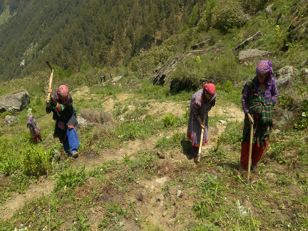
Dayara Bugiyal Trek
Brief Description
Overview
Region: Garhwal (Uttarakhand)
Trekking Altitude: Max (3810 mtrs)
Grade: Easy to Moderate
Total Trekking Distance: 23 Kms
Best Season: May to November. But it is accessible the entire year. The trek offers exciting winter trekking from December to March. Difficulty level in this period is moderately challenging.
Temperature Range: -7°C to 25°C.
Brief Information
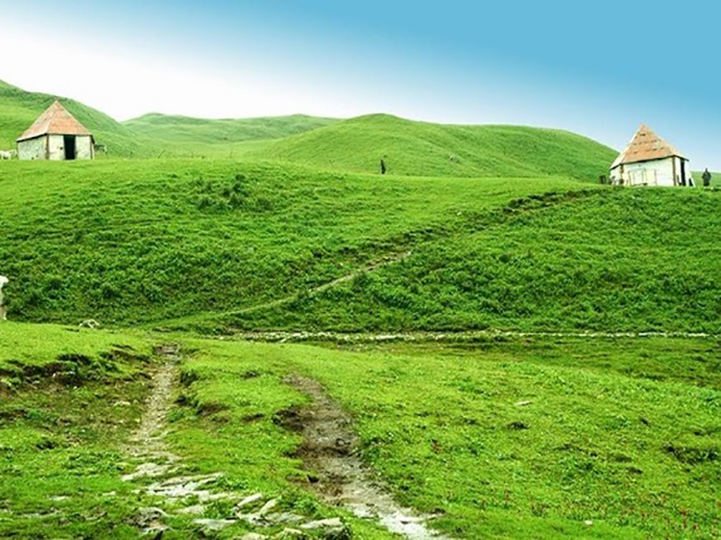
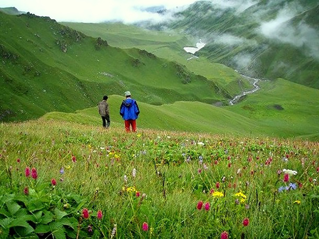
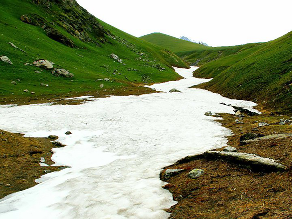
In Uttarakhand, Bugyal is a generic name for beautiful sprawling level or gentle slopes meadows that bloom with a profusion of multi colored flowers and inviting green grass in the summers and are covered with snow during winter, making them perfect ski slopes. Dayara Bugyal is one such meadow that lies in the region of Uttarkashi and literally means “high altitude meadow”. It lies at an elevation of 11,181 feet (3,408 metres) and covers an area of 28 square kilometers. In winters it turns into a delightful, pristine ski slope that can be used for alpine as well as Nordic skiing. It is being planned as a new ski resort in Uttarakhand but as of now, there is no direct road to it, and it requires trekking from the last roadhead at Barsu village. It is home to the famous Himalayan Monal, a type of colorful pheasant that is the state bird of Uttarakhand as well as the national bird of Nepal. The trek is extremely beautiful and can be undertaken in summer or winter. In summer, it is a riot of color all along the entire length of the meadows, while in winter; it is a sea of inviting snow. The trek is pretty easy in summer, while in winter, it is much more difficult owing to the soft snow that makes walking more strenuous.
Short Itinerary
Day 1: Drive from Delhi to Haridwar (215 Kms, 5 to 6 hrs), Overnight stay in hotel at Haridwar.
Day 2: Drive from Haridwar to Barsu 2300 mtrs(157 Kms, 5 to 7 hrs), Overnight stay in hotel at Barsu.
Day 3: Trek from Barsu to Barnala 2600 mtrs (4 Kms, approx 3.5 hrs), Overnight camping at Barnala Tal.
Day 4: Trek from Barnala to Dayara Bugyal 3564 mtrs (5 Kms , approx 3 hrs), Overnight camping at Dayara Bugyal
Day 5: Trek from Dayara Bugyal to Bakaria top 3810 mtrs and back to Dayara Bugyal(4 Kms,3 hrs), Overnight camping at Dayara Bugyal
Day 6: Trek from Dayara Bugyal to Barsu via Barnala(10 Kms,4 hrs) & Drive from Barsu to Uttarkashi(19 Kms, 1 hr), Overnight stay in hotel at Uttarkashi
Day 7: Drive from Uttarkashi to New Delhi (450 Kms, 10 to 12 hrs)
Essential: Do's and Don't / Things to Bring / Inclusion and Exclusion (PDF)
Dayara Bugiyal Trek - Fact and Info (PDF)
Dayara Bugiyal Trek - Detailed Itinerary (PDF)
Fact & Info
INTERESTING FACTS/INFORMATION ABOUT THE PLACE
The Bugyals of Uttarakhand
The Bugyals (or high altitude alpine meadows ranging between approximately 9,000 to 11,000 feet) of Uttarakhand are large gently sloping verdant summer grasslands that turn into superb ski slopes during winter. They are some of the most beautiful spots in the mountains, with their beauty rivaling the meadows of the Austrian, Swiss and Italian Alps. Some of the most famous bugyals are the Auli Bugyal (that is the primary ski resort of Uttarakhand), the Bedni Bugyal which is part of the route that leads onto RoopKund lake and the Dayara Bugyal that along with the Barnala Bugyal is a huge meadow with spectacular views of the Gangotri peaks.
UttarkashiUttarkashi town is the district headquarters of Uttarkashi and is situated along the banks of the river Bhagirathi. It is well known for its ashrams and temples and also because it is home to one of the best Mountaineering Institutes in india – the Nehru Institute of mountaineering. It was named as Uttarkashi (The Kashi or Varanasi of the North) since its topography and location along the banks of the Bhagirathi bears close resemblance to the city of Varanasi that lies along the river Ganga. Uttarkashi is very famous among adventure enthusiasts as it offers white water rafting along with some excellent trekking routes and mountaineering expeditions into the Gangotri region. Uttarkashi is also the site of a couple of hydro electric power project (the TilothPower Plant) dams at Maneri (Maneri Dam) and Joshiyari village (Bhali Dam) Uttarkashi is also the biggest town and main centre for trekking supplies and guides for all treks going into the Gangotri and Yamunotri regions.
DoditalDodital (at 3,307 mtrs) is a beautiful lake that lies 21 kms from Uttarkashi and is approached via a trek that starts from Uttarkashi via the village of Sangamchatti. Some trekkers also combine the Dodital trek with the Dayara Bugyal trek as the routes do converge a short distance away from Bakaria Top. Dodital is known in legend as the lake that Lord Ganesha chose as his abode. It is also amazingly inhabited by the brown trout and the Himalayan trout.
Darwa TopA steep ascent from Dodital takes one to Darwa Pass, from where yet another steep walk takes you to Darwa Top (at 4,130 mtrs). The peaks visible from here are the Gangotri range, with the most notable being Swargarohini, Bandarpoonch and Hanuman Tibba (which lies in Himachal Pradesh)
YamunotriThe source of the river Yamuna lies atop a flank of Bandarpoonch mountain at an altitude of 3,293 mtrs, in the westernmost Garhwal Himalayas. It is also regarded as the seat of Goddess Yamuna and the shrine is named as Yamunotri in her honour. It is a popular pilgrimage location and one of the most important “char dhams” of Hindu Pilgrimage. It is located about 30 kms North of Uttarkashi. The actual source of the river is the Champasar Glacier that is located on the Kalind Mountain about 8 kms away from the shrine and almost 500 metres above! (at 4,421 metres). The approach is extremely difficult and dangerous and it is regarded as inaccessible. The deity of the temple is made of black marble and was placed by Maharaja Pratap Shah of Tehri Garhwal. There are number of hot springs gushing out of the cracks in the mountains here, which pool and form steaming ponds (or “kunds”). The most important among these is the Surya Kund. Hot springs are also found about 7 kms away at a place known as Janki Chatti. The temple closes for winters on Diwali day and reopens in summer on the auspicious day of Akshaya Tritiya.
Dayara Bugiyal Trek - Fact and Info (PDF)
Detailed Itinerary
Day 1: Drive from Delhi to Haridwar (215 Kms, 5 to 6 hrs), Overnight stay in hotel at Haridwar.
The drive from Delhi to Haridwar is via NH 58, skirting past Meerut and Muzaffarnagar. It takes about 4-6 hours depending on the traffic, with Haridwar making its presence known as you see the wide banks of the river Ganga and the sacred bathing ghats with their numerous temples along it. We will check in to the hotel and later in the night proceed for a walk along the river banks to take in the sights of the holy city.
Day 2: Drive from Haridwar to Barsu2300 mtrs(157 Kms, 5 to 7 hrs), Overnight stay in hotel/camping at Barsu.
From Haridwar, we will have to leave early since the drive all the way till Barsu is pretty time consuming. We will start climbing upwards via Mussoorie, Dhanaulti, Chamba, Chinyalisaur and Dharsu to reach Uttarkashi. From Uttarkashi onwards, the road becomes rough and steep, passing via Bhatwari before finally ending up at Barsu. 13 kms further ahead, where we will be staying overnight.
Day 3: Trek from Barsu to Barnala2600 mtrs (4 Kms, approx 3.5 hrs), Overnight camping at Barnala Tal.
The trek today is easy and relatively short, and is a precursor of the natural bounty that lies ahead. We will walk around the artificial pond that lies close to the GMVN Resort, until we meet a well defined path that leads into a thick oak, deodar and rhododendron forest. In autumn, leaves shed by the trees make a delightful carpet to walk on and it’s a soothing walk as you walk along, softly crunching the leaves underfoot.
After about half an hour, you will come across the Herbal garden to your right which you can visit on the return leg of the journey. After this, the walk continues along gradually undulating slopes with a few steep sections that are fairly short and easy to negotiate. After almost an hour you will reach the top of the first ridge from where Barsu can now be seen in the distance as a collection of toy-like miniatures.
The trail levels out now and four gujjar (shepherd) huts make their appearance, spaced out by a few metres. From here the trail will curve away to the right and after hardly 5-10 minutes of walking, the lovely green and inviting Barnala meadows will spread out in front of you.
To the left, in the shadows of the thick oak trees that fringe the meadows, you will see the lovely Barnala Tal (lake) and soaring behind the oak trees is the first glimpse of the striking Gangotri range of mountains that beckon invitingly. They will however need to wait for the next day, as we will be camping here for the night.
Day 4: Trek from Barnala to Dayara Bugyal3564 mtrs (5 Kms , approx 3 hrs), Overnight camping at Dayara Bugyal
Today the trek will be more strenuous than yesterday, but the view at the end will leave you mesmerized and make you forget the effort you put in. We begin our trek continuing along the same path further ahead into the tree line. The hike is noticeably steeper and switches back and forth regularly, gaining height rapidly. The meadows of Barnala and Barnala Tal will soon be looking small behind you, while every switchback tantalizes you with the Gangotri peaks getting larger and new peaks starting to appear peeking above the ridge. The pace will increase noticeably as the anticipation increases and finally at the top of the ridge, you get the complete spell-bounding vista of the incredibly beautiful Dayara Bugyal laid out in front of you for as far as the eye can see and the spectacular Gangotri range now completely framing the horizon stretching to 180 degrees from the left to the right.
The most stunning peaks are the Bandarpoonch and Kalanag (Black Peak) that will take your breath away with their appearance so close to you.
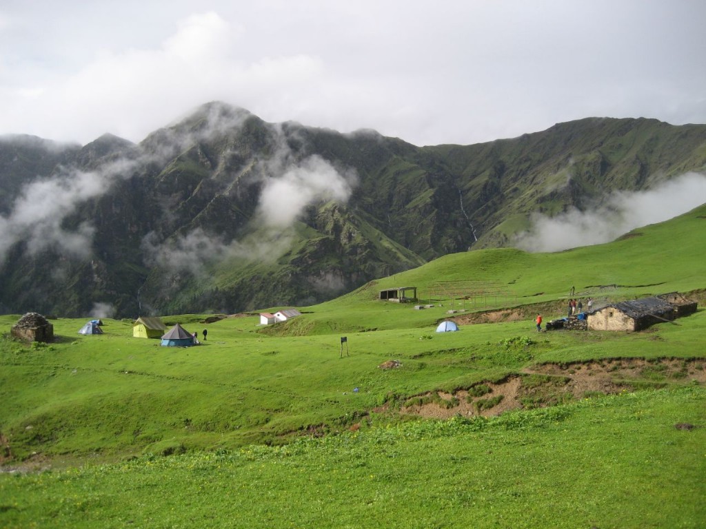
Enjoy the sights for a while and then move ahead to the campsite which is at the fringes, past the shepherd huts, since that is where the water-bodies are. The meadows get quite windy at times and it’s important to make sure the camp is well set up as you turn in for the night.
Day 5: Trek from Dayara Bugyal to Bakaria top3810 mtrs and back to Dayara Bugyal(4 Kms,3 hrs), Overnight camping at Dayara Bugyal
From the campsite you can see various trails. The trail directly ahead splits into two.One trail leads to a small village called Raithal, while the other leads to a water body. The trail we will be taking today, however, is the well defined trail that passes through the middle of the meadows. We will move up and to the right gradually till we reach the base of the first ridge line called Moosa Dhangi, thus named for its proliferation of burrowing rats and moles a long time ago. Although we are not yet at Bakaria Top, the Bandarpoonch and its companion peaks already seem even closer than before and look spectacular against the morning sun.
From here, Bakaria Top is at a corner of the meadows and is the highest point, 3 ridges away. We scramble over the ridges and onto the other side until finally we reach the final ridge where a really spectacular view awaits us in all directions. On one side is the village of Agoda in the distance and the alternate trek route to Dodital, while on the other side you can see the entire Dayara Bugyal with the truly mesmerizing Gangotri peaks all around you. The town of Uttarkashi can also be seen far away on a clear day.
We can now spend some time exploring and enjoying the beautiful meadow, hoping for a glimpse of the unique wildlife such as the elusive mountain cat or a sporadic deer and the colourful pheasants that are denizens of the high Himalayan meadows. You can also see a few beautiful water bodies dotted along the bugyal where you can try and catch a glimpse of the peaks in the placid water.
After a while of exploration, we will have to turn back and descend to our camp which will be a fairly easy walk as most of it is downhill.
Day 6: Trek from Dayara Bugyal to Barsu via Barnala(10 Kms,4 hrs) & Drive from Barsu to Uttarkashi(19 Kms, 1 hr), Overnight stay in hotel at Uttarkashi
While returning we will be taking the same route down to Barsu. It will of course be much easier and faster since most of it is now downhill and level. If we are lucky, we might catch a glimpse of grazing cattle and sheep, which make for excellent photo opportunities.
On our return, we can stop by the Herbal Garden near Barsu for a short while and explore the various indigenous herbs found in the region. By around noon or a little later, we will drive back to Uttarkashi.
Day 7: Drive from Uttarkashi to New Delhi (450 Kms, 10 to 12 hrs)
The return drive to New Delhi is along the same road we had taken while coming, down the slopes of Garhwal and finally onto the plains from Haridwar onwards till Delhi.
