Chopta Chandershilla Peak Trek
Brief Description
Overview
Region: Garhwal, Uttarakhand
Trekking Altitude: Max (4130 mtrs)
Grade: Easy to Moderate
Total Trekking Distance: 30 Kms
Best Season: May to mid July, September to December; mid February to end March
Temperature Range: -7°C to 25°C.
Brief Information
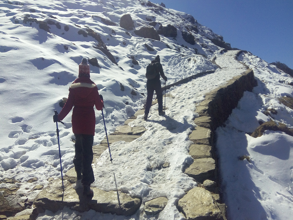
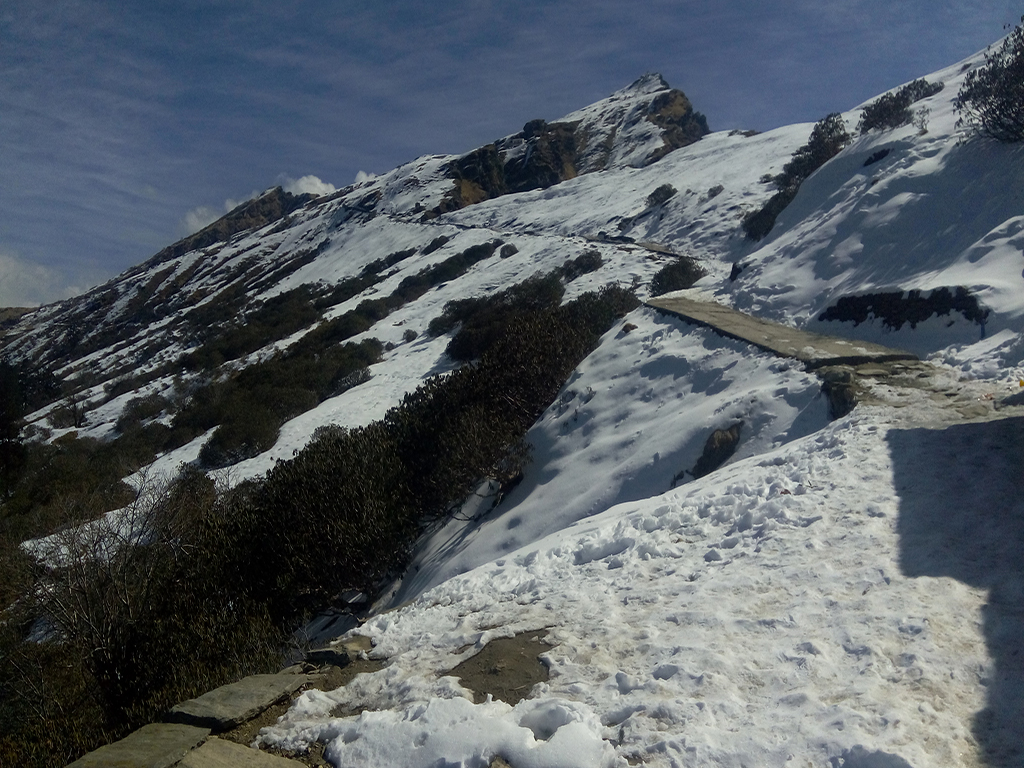
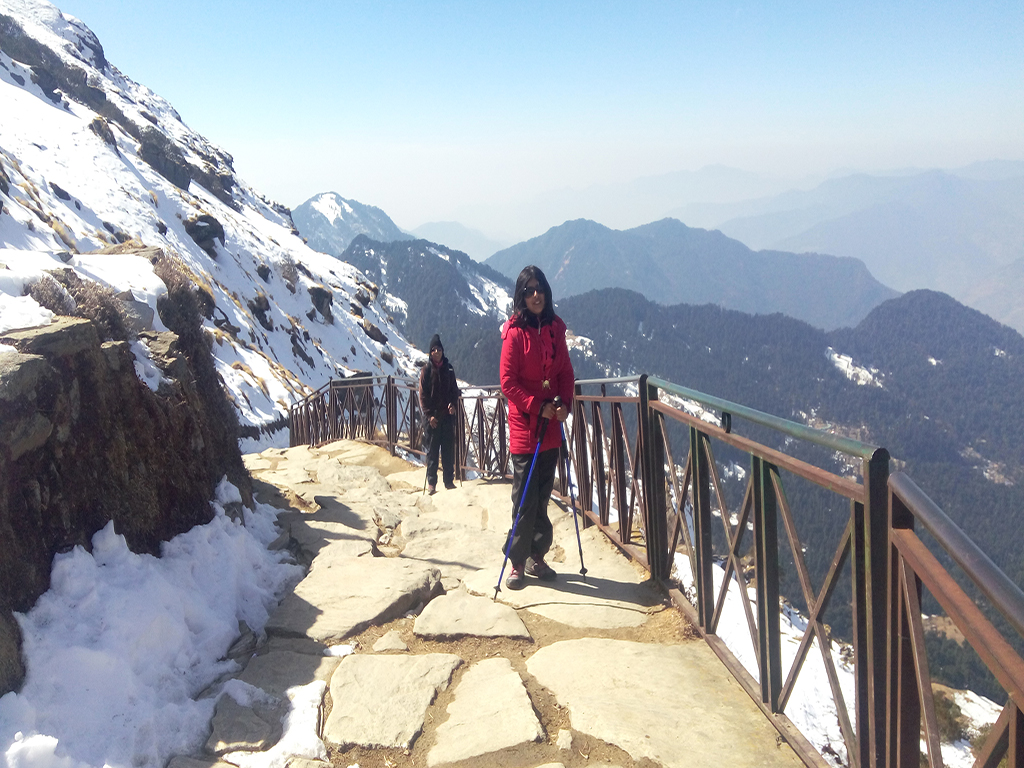
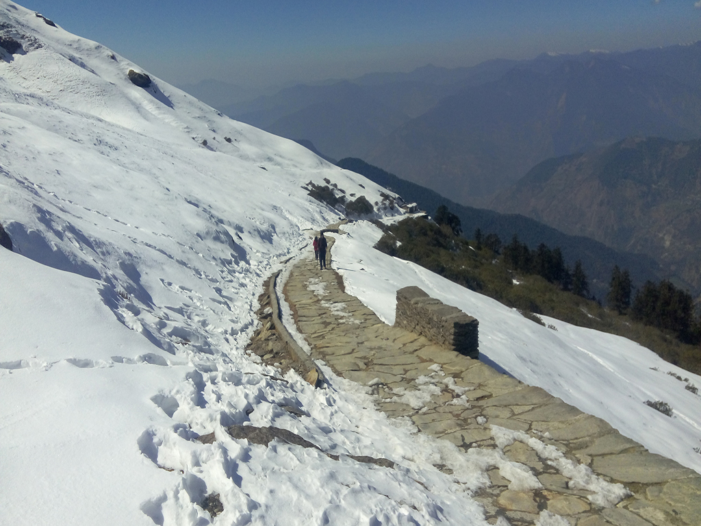
Chandrashila Deoria Tal Tungnath Chopta trek is one of the most popular treks in India primarily because it is one of the very few treks that can be done in summer as well as winter, providing two completely different experiences. Another reason for its popularity is the short duration of the trek which makes it very attractive for working professionals. En route you camp at Deoria Tal which has magnificent view of the Garhwal Himalayas, especially the four tiered Chaukhamba that dominates the skyline. Another highlight is the ancient Shiva temple at Tungnath (purported to be the highest in the world) above which lies the summit that gives an epic, unforgettable view of the snow capped majesty. The trek is easy to moderate in the summers since it has a well defined flagstone path, but in winter, due to heavy accumulation of snow (sometimes knee deep snow) the level of effort is considerably multiplied. It is still however one of the best treks for easy accessibility to panoramic views.
Short Itinerary
Day 1: Drive from Delhi to Srinagar (350 Kms, 8 to 9 hrs), Overnight stay in hotel at Srinagar
Day 2: Drive from Srinagar to Sari (80 Kms, 2 to 3 hrs) & Trek from Sari 2121mtrs to Deoria Tal 2438mtrs(3 Kms, 1 to 2 hrs), Overnight Camping.
Day 3: : Trek from Deoria Tal to Rohini Bugyal 2730 mtrs (8 Kms, 4 to 5 hrs), Overnight Camping
Day 4: Trek from Rohini Bugyal to Bhrujgali 3300 mtrs(6 Kms, 3 to 4 hrs), Overnight Camping
Day 5: Trek from Bhrujgali to Tungnath 3680mtrs to Chandrashila Summit 4130mtrs and back to Bhrujgali and then to Chopta 3000mtrs (13 Kms, 7 to 8 hrs), Drive from Chopta to Srinagar (55 Kms, 2 to 3 hrs), Overnight stay in hotel at Srinagar
Day 6: Drive from Srinagar to New Delhi (350 Kms, 9 to 10 hrs).
Essential: Do's and Don't / Things to Bring / Inclusion and Exclusion (PDF)
Chopta Chandershilla Peak - Fact and Info (PDF)
Chopta Chandershilla Peak - Detailed Itinerary (PDF)
Fact & Info
INTERESTING FACTS/INFORMATION ABOUT THE PLACE
Deoria Tal
Deoria (Also spelled as Devaria' or 'Deoriya) lies in the Rudraprayag district of the Garhwal region, Uttarakhand. It is a beautiful oval lake that lies in the midst of tree fringed meadows that gives a rare 300° panorama of some of the highest and most famous peaks of the Garhwal Himalaya such as the massive Chaukhamba, Bandarpunch, Kedar Dome and Kalanag. The trek upto the lake can be undertaken from either Sari or Mastura villages, both of which are accessible from Ukhimath.
MythologyThe lake has been mentioned on various occasions in the Mahabharata and has been named due to the belief that the Devas (Gods) bathe in the lake. Legend says that while the Pandavas were wandering through the forests on their journey of penance after the Mahabharata war, they arrived at this lake tired and thirsty. The lake was guarded by a Yaksha, who allowed them to drink water on the condition that they answer his questions. All of them ignored his philosophical questions out of thirst and drank the water, and subsequently fell dead. The only exception was the eldest, Yudhishthira(famed for his wisdom), who patiently listened to the question and answered it correctly. The lake is also considered as being the “Indra Sarovar” mentioned in the Puranic texts.
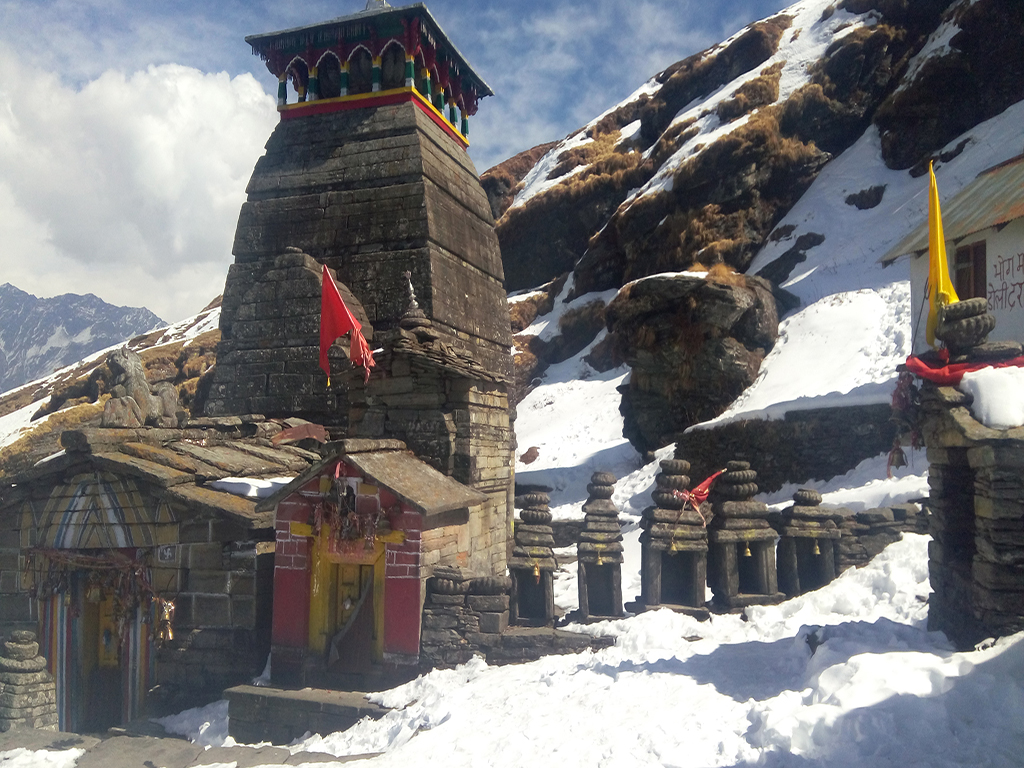
TungnathThe western Garhwal region is synonymous with Lord Shiva and is also known as the Kedar Kshetra (Kedar being the local name for Lord Shiva). Within the region lies the famed Panch Kedar, the five holiest temples dedicated to Lord Shiva. Among the five temples, the Tungnath temple located at an altitude of 12,070 feet is the highest (even higher than the famed Kedarnath temple) It is a beautiful temple built in the traditional stone architecture of the region and has withstood the elements to retain its beauty amid seclusion through more than 1000 years! It commands an uninterrupted view of the surrounding mountains and is a fantastic location to view the sunrise and sunsets. The priest at Tungnath is a local Brahmin from Maku village, unlike the other Panch Kedar temples where the priests are from South India, a tradition set by the eighth century Hindu seer Adi Shankaracharya. During winter, the temple is largely inaccessible due to heavy snow. During this season, the representational idol is worshipped at the Mokumath temple, lower down in altitude, close to Ukhimath.
LegendThe Tunganath temple is one of the Panch Kedar temples and its myth is linked with the Pandavas in their search for forgiveness after the end of the Mahabharata war, where they committed the crime of slaying their cousins (The Kauravas) who were also Brahmins. On the advice of Rishi Ved Vyas, they went to Kasha in search of Lord Shiva, who knowing their guilt, did not wish to forgive them since he was convinced of their guilt, and instead chose to evade them by changing his form to that of a bull and hiding among the pastures of Guptkashi (literally translated as the Secret or Hidden kasha) in the Garhwal mountains. Realizing that Lord Shiva might be in the mountains, the Pandavas went in search of him, and they finally spotted him in the guise of a bull. When Bheema caught hold of him, Shiva disappeared into the ground and materialized in five different locations as different body parts of the bull. Knowing that they would only attain forgiveness by penance and meditation in all five sites, the Pandavas went to all the locations and built the famed “Panch Kedar” shrines where they meditated and prayed, and eventually earned the right to ascend to heaven. The temple of Tungnath is where the “bahu” or the hands of the bull materialized.
ArchitectureThe temple is constructed in the typical North Indian architecture style prevalent in the region, and seen at the Madhyamaheshwar and Kedarnath shrines. The entire temple is constructed of stone blocks with decorations depicting tall towers, with even the domed roof made of stone slabs. The top of the dome is crowned by a square cornice that has a total of sixteen arched openings, four in each direction. The roof is crowned with a tall golden shikhar and kalash. Tungnath temple is smaller in size as compared to the Kedarnath temple and can barely hold upto 10 devotees at a time. The main temple is surrounded by smaller shrines devoted to a number of other Gods. The inner sanctum of the temple has the “swayambhu” (self manifested) Shivlinga, a black rock that rose out of the ground by itself. The credit for construction of the temple goes to Arjuna of the Pandavas.
GeographyTungnath is at the top of the ridge dividing the waters of the Mandakini River from those of the Alaknanda. The topography of the Chopta/Tungnath valley is a gentle slope with speckled green terrace farming, tall alpine trees and bright crimson and pink rhododendrons (they only bloom during summers; during winters they look like a dense forest of tall scraggly shrubs) The region is also famous for its Musk Deer and is designated as the Kedarnath Musk Deer Sanctuary. If time permits, you can also visit Kharchula Kharak near Chopta where you will find the musk deer Breeding centre.
Chandrashila PeakAbout a kilometer above the Tungnath temple, after a steep trek, lies the Chandrashila (literal meaning – Moon-Rock) Peak. It has a lot of legends associated with it, and was thus named because the Moon God (Chandra) is said to have done his penance here. The peak is also unique in the Ramayana as curiously, not only did Lord Rama meditate here, but his adversary, Ravana, also did penance here to gain Lord Shiva’s blessings! For modern day trekkers and lovers of nature, it is no wonder, as the peak has an uninterrupted 360 degrees vista as far as the eye can see, of the great Himalayan peaks of Nandadevi, Trisul, Kedar Peak, Bandarpunch and Chaukhamba. Curiously, owing to it being open on all sides, the winter snow here melts faster than the Tungnath temple, which lies in the shadow of the mountain and retains its snow accumulation for a longer period of time.
ChoptaChopta is also known as the "Mini Switzerland of Uttarakhand" due to its varied flora and fauna, with plenty of Rhododendron and Deodar trees all around. It is a sleepy hamlet at approximately 2700 metres and is not yet as crowded as compared to the other tourist spots. It is becoming quite popular of late due to the possibility of summer and winter weekend treks upto 4000 metres, with uninterrupted views of the Himalayan ranges.
Chopta Chandershilla Peak - Fact and Info (PDF)
Detailed Itinerary
Day 1: Drive from Delhi to Srinagar (350 Kms, 8 to 9 hrs), Overnight stay in hotel at Srinagar
The drive to Srinagar (the largest city in the Garhwal Himalaya) is a long one and goes from Delhi to Haridwar, Rishikesh, Devprayag, Pauri and then finally ends at Srinagar. The route from Delhi till Rishikesh is along a generally level highway and is covered fairly quickly. From here on, the road gets narrower as it starts climbing the Himalayan foothills in a series of switchbacks that have a sheer gorge on one side. After a long drive, we will finally end up at Srinagar in the evening. If you are up to it, you can walk down to the various Mahadev temples along the banks of the Alaknanda river in the evening and witness the late aarti.
Day 2: Drive from Srinagar to Sari (80 Kms, 2 to 3 hrs) & Trek from Sari2121 mtrs to Deoria Tal2438mtrs (3 Kms, 1 to 2 hrs), Overnight Camping.
Drive to Sari Village, the starting point of the 3 Kms trek to Deoria Tal. Gradually ascending trail through the forests of rhododendron, alpine and oak trees will end up at Deoria Tal. The path is well made and broad too. It just takes around 1.5 hours to reach Deoria Tal from Sari Village. Deoria Tal is a gorgeous lake nestled amidst elevated meadows with few huts nearby that provide accommodation.
The reflection of Himalayan range on the pristine waters of this lake is a view that will be etched in your minds forever.
Day 3: Trek from Deoria Tal to Rohini Bugyal 2730 mtrs (8 Kms, 4 to 5 hrs), Overnight Camping
The trail to Rohini Bugyal is across rolling hills, without any steep ascents. The route passes through some of the most beautiful forests rich in a wide variety of flora. Red and pink colored Rhododendrons will greet you at every step.
You need to cross Jhandi Dhar while trekking towards Rohini Bugyal. Jhandi Dhar (2,650mts) is a ridge top which offers clear views of Kedar Dome and Chaukhamba Peaks. Chandra Shila Peak also becomes visible after trekking for a few kilometers.
There are very few water sources along this stretch, so do carry extra water! It is advisable that you carry at least two water bottles to ensure a comfortable hike.
Perched at an elevation of 2730 meters above sea level, Rohini Bugyal is a small meadow but a beautiful campsite which offers stunning views of Himalayan peaks.
Day 4: Trek from Rohini Bugyal to Bhrujgali 3300 mtrs (6 Kms, 3 to 4 hrs), Overnight Camping
A short hike of 6 Kms from Rohini Bugyal ends up at Bhrujgali. It takes around 3.5 hours to complete this stretch. Initially the route climbs up gradually to Tikdi Khal (2,800mts) where you’ll encounter two diversions in the route. The straight trail leads to Bisuri Tal, a high altitude glacial lake whereas the trail on the right with steep descent goes towards Akash Kamini stream coming from Chandrashila.
Continue walking towards the Akash Kamini stream. After crossing the stream continue walking uphill to reach Lower Bhrujgali meadows surrounded with dense forest. It is a good camping spot but if there is time remaining, it is advisable to continue trekking towards Bhrujgali since that will save time tomorrow morning in order to be able to enjoy the dawn glow from Chandrashila. In less than an hour you’ll reach Bhrujgali meadows, where you will see a well made trail that leads to Tungnath. This will be our campsite for the night.
Day 5: Trek from Bhrujgali to Tungnath 3680 mtrs to Chandrashila Summit 4130 mtrs and back to Bhrujgali and then to Chopta 3000 mtrs(13 Kms, 7 to 8 hrs), Drive from Chopta to Srinagar(55 Kms, 2 to 3 hrs), Overnight stay in hotel at Srinagar
Start early in the morning in order to see the sunrise from Chandrashila. This entire region comes under the Kedarnath Musk Deer Sanctuary so there are chances that you might spot wildlife in the morning including Wild Goat and Himalayan Monal. The trail from Bhrujgali to Tungnath temple is broad and well maintained. During today’s trek you will be gaining altitude in a very short distance due to the climb being steep.
During the final stretch to reach Tungnath you will see a rocky cliff on the right which is known as Raavan Shila. You can take a short break here, prior to the final ascent up to Tungnath Temple.
Magnificent in its style and architecture Tungnath is considered to be more than a 1000 years old. The main temple is dedicated to Lord Shiva and other small rock temples in the vicinity are dedicated to Goddess Parvati. The temple remains closed during winters.
Another 1 Km steep hike from Tungnath temple will lead you to Chandrashila Summit. The trail becomes narrow as we climb up the meadows of Chandrashila Peak. Chandrashila is the summit of the mountain on which Tungnath temple is situated. A beautiful small temple is situated on the summit along with several unique cairn structures. Chandrashila is perched at an elevation of 4,130 meters above sea level offering splendid views of the majestic Himalayan peaks including Kedar Dome, Chaukhamba, Nanda Devi, Trishul, Nanda Ghunti, Kamet, Gangotri Ranges & more.
Spend some time at Chandrashila Summit witnessing the heavenly horizon and then start descending towards Bhrujgali. Chopta is another 1 Km downhill hike from Bhrujgali that just takes around 20 mins to traverse.
Accommodation facilities are available at Chopta but we will drive back to Srinagar where we will stay for the night.
Day 6: Drive from Srinagar to New Delhi (350 Kms, 9 to 10 hrs).
This is pretty much the same return drive to Delhi, as we traverse the tricky switchbacks with the Alaknanda flowing deep below. Once the steep sectors, prone to landslides, are complete, the drive from Haridwar onwards is pretty quick and we should be in Delhi by late evening.
