Roop Kund Trek
Brief Description
Overview
Region: Uttarakhand
Trekking Altitude: Max (4920 mtrs)
Grade: Moderately Tough
Total Trekking Distance: 70 Kms
Best Season: Mid May to Mid June, September to October
Temperature Range: -5°C to 23°C.
Brief Information
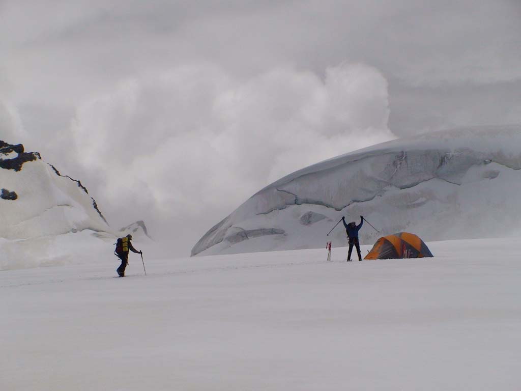
A trek to Roopkund is a fantastic experience for new as well as experienced trekkers. It offers so many amazing experiences that are unique such as walking along the biggest meadow in Asia, and that too for a couple of days! The trek route also passes through the village of Wan that is famous for its protected forest where you find giant cypress trees that are half a millennia old and have massive girths, not found anywhere else in India. Not only does the trek take one through the experience of the lush meadows, it also takes the trekker through a unique snow experience where you trek through snow that can sometimes be knee deep with vast fields of snow extending in all directions! To add to it, the ridge just above the lake, Junargali, is the best place to take in the huge, trident shaped Trishul range that stands right above you, covering the entire line of sight! To add to the natural beauty, the trek also has its share of mysteries and myths, especially the presence of hundreds of skeletons dating back to the 9th century AD at this high altitude glacial lake far away from any kind of trade route! Even the places enroute – such as Kalu Vinayak and Pathar Nachauni have their own legends associated to them. This trek though is not an easy trek since it involves a fair amount of altitude gain which may cause AMS, hence care needs to be taken to stay hydrated and take it easy. In addition to this are the open, unprotected ridges after Kalu Vinayak, till Bhagwabasa and also the final ascent from Bhagwabasa to the Roopkund ridge. Due to the unusual topography, there is always the possibility of high speed freezing winds blowing in, which can cause snow, rain and hail without warning. The last ascent to Roopkund can also be quite tricky with the possibility of knee deep snow. All this however, adds to the charm of this incredible trek that is pretty much a must-do on any trekkers list.
Short Itinerary
Day 1: Drive from Delhi to Bageshwar (450 Kms, 10 to 12 hrs), Overnight stay in hotel at Bageshwar.
Day 2: Drive from Bageshwar to Loharkhet 1829 mtrs(40 Kms, approx 2 hrs), Trek from Loharkhet to Dhakuri 2683 mtrs (9 Kms, 4 to 5 hrs), Overnight stay in guest house at Dhakuri.
Day 3: Trek from Dhakuri to Khati 2210 mtrs (10 Kms, 5 to 6 hrs), Overnight camping at Khati.
Day 4: Trek from Khati to Phurkiya 3260 mtrs (16 Kms, 7 to 9 hrs), Overnight camping at Phurkiya.
Day 5: Trek from Phurkiya to Zero point 3750 mtrs and then back to Dwali 2734 mtrs (17 Kms, 9 to 10 hrs), Overnight camping at Dwali.
Day 6: Trek from Dwali to Dhakuri (21 Kms, 9 to 10 hrs), Overnight stay in guest house at Dhakuri.
Day 7: Trek from Dhakuri to Loharkhet (9 Kms, 3 to 4 hrs), Drive from Loharkhet to Ranikhet (140 kms, 4 to 5 hrs), Overnight stay in hotel at Ranikhet
Day 8: Drive from Ranikhet to Delhi (350 kms, 8 to 9 hrs)
Essential: Do's and Don't / Things to Bring / Inclusion and Exclusion (PDF)
Roop Kund Trek - Fact and Info (PDF)
Roop Kund Trek - Detailed Itinerary (PDF)
Fact & Info
INTERESTING FACTS/INFORMATION ABOUT THE PLACE
Nainital
Nainital is a beautiful hill station in the foothills of the Kumaon Himalayas in the state of Uttarakhand. The name is derived from the myth as per which the eyes of the Sati Parvati fell here and formed the Naini Lake, while Lord Shiva was carrying her remains. The town receives snowfall in the winter and is famous for the magnificent vistas of the stunning Kumaon Himalayan range from the Naina Peak (8,593 feet)
Nanda Devi Raj Jat YatraThe Nanda Devi Raj Jaat (Yatra) is held once in 12 years and begins from the village of Nauti near Karnaprayag all the way up to the heights of Roopkund and Homkund further ahead. It is the biggest festival in the Kumaon region and passes through every village that has a major shrine dedicated to Nanda Devi. The pilgrims walk barefoot all the way till they reach Homkund where the yatra ends. There is a belief that if a special four horned ram(male sheep) appears, it will be the most auspicious and blessed event.
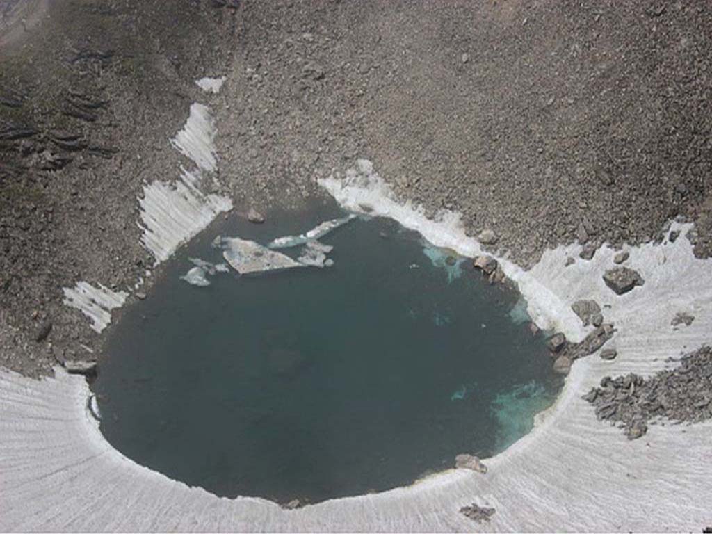
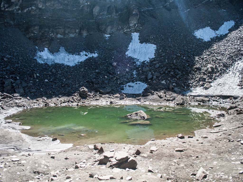
The Roopkund MysteryIn 1942, a park ranger stumbled across hundreds of skeletons lying around the lake. On carbon dating, it was ascertained that the skeletons were from around 850 AD and seemed completely out of place, since Roopkund is not part of any trade route and it is a mystery where they were headed. Their death itself is also a mystery although the strong belief is that they were struck by huge sized hailstones that cracked their skulls and caused death.
Mt. Trishul groupMt.Trishul is a unique peak group with its fantastic three pointed peaks that resemble a trishul (trident). Trishul I was the first 7000 metre peak to be climbed in India(1907). The group looks unbelievably beautiful at sunrise and sunset and the Roopkund trek is the best trek to view it in all its glory as it goes extremely close to the base of the range with Junargali, above Roopkund, being the last ridge facing the Trishul group.
Bedni and Ali BugyalUttarakhand is famous for its fantastic high altitude meadows, known as Bugyals. They are a lush expanse of soft green grass during summers and a huge expanse of snow fields during winter, all fringed by incredibly beautiful snow capped peaks. Bedni Bugyal is the largest such meadow in Asia while Ali Bugyal right next to it is also almost as big, and together, the two make an unforgettable experience during the trek.
BhagwabasaBhagwabasa is the base camp for Roopkund lake and lies just below the final ridge to the lake. It commands a spectacular view of the valley far in the distance and the snow capped massifs looking huge on the horizon. Bhagwabasa lies along the snow line and is mostly covered by snow. It is also extremely cold due to an unprotected ridge around it that brings freezing winds and lead to precipitation. The weather can also change pretty quickly, which makes this a pretty tough place to camp.
Roop Kund Trek - Detailed Itinerary (PDF)
Detailed Itinerary
Day 1: Drive from Delhi to Nainital (310 Kms, 7 to 8 hrs), Overnight stay in hotel at Nainital
We begin our trek with an early morning drive to Nainital. The route starting out from Delhi is flat but starts getting tricky as we begin ascending the twisting roads of Uttarakhand that lead towards the Chamoli district. The route leads out due east passing through Noida and then Moradabad after which it heads North East via Rampur. From the town of Kaladhungi, the road begins ascending the hilly slopes until it reaches the beautiful lake town of Nainital where we will halt for the night.
Day 2: Drive from Nainital to Lohajung 2130 mtrs (203 Kms, 5 to 7 hrs), Overnight camping or stay in hotel/guest house at LohajungFrom Nainital to Lohajung, the road ascends steadily up past towns that are by themselves beautiful spots to take a break and relax, with their splendid views of the Himalayan ranges. We will drive till Almora from where we will turn left and carry on along the road upto the beautiful town of Kausani where we can have a break and stretch our legs a bit. From Kausani we will continue onwards passing Baijnath, Gwaldam and Dewal as we finally arrive at Lohajung and rest for the night.
Day 3: Trek from Lohajung 2130 mtrs to Didina 2450 mtrs (10 Kms, 5 to 6 hrs),Overnight campingEarly morning, we pick up our sacks and begin this beautiful trek along what will be a fairly easy day. The initial 4-5 kms are downhill with the remainder uphill as we attempt to reach Didina village which lies on the neighbouring hill visible from Lohajung. The clear morning skies brings out the beauty of Mt. Trishul and Mt. Nanda Ghunti peaks in the distance, the peaks that will get ever closer with each passing day and will be our constant companion. After the village, we will enter the dark forest that fringes its edge and will continue to walk through it for about 45 minutes, following the increasing sound of the rushing Neel Ganga till we reach its banks, where we can take a short rest and replenish our bottles. We will then cross the iron bridge and begin the ascent on the other side. The ascent is gradual at first but then starts to steepen as it leads up along a rocky trail through the trees. After about an hour’s worth of climbing, we finally reach our destination for the night – the small village of Didina, a picturesque little village surrounded by dense oak forests.
Day 4: Trek from Didina to Pathar Nachauni 3890 mtrs via Ali Bugyal 3300 mtrs (13 Kms,7 to 8 hrs), Overnight campingJust beyond the Didina village are the dense oak forests and that is where we will head off to early in the morning. These protected oak forests are one of the thickest oak forests in India, a truly amazing experience to walk through them crunching the thick carpet of dry leaves, amid the dark boughs of the trees. The trek proceeds by ascending up along the oak forests for about 3-4 hours, ascending all the way and making it fairly demanding. The climb, though tiring, is beautiful and just as we get used to staying in the shade of the dense oaks, the treeline suddenly disappears and the vast, beautiful meadow of Ali Bugyal will appear for as far as the eye can see! It is an abrupt transition that leaves you speechless! The climb however, seems to get steeper as we shuffle along in wide zig-zag traverses. After about a couple of hours, we finally reach the top of the Ali Bugyal where we will be stunned by the sudden sight of the massive and beautiful three pointed mountain peak of Mt. Trishul, hanging over you, dominating the entire horizon! This is where the beauty of the trek begins to sink in. We will take some time off, walking barefoot in the soft grass and have lunch, and then proceed. The walk from here takes about a couple of hours and is along gentle ascents and descent along ridges covered by the massive meadow, until we reach Bedni Bugyal. By the time we reach Bedni Bugyal, we will all be marveling at the beauty and sheer spread of the twin bugyals that are the largest high altitude meadows in Asia. This is one of the most spectacular camp sites in Uttarakhand and is fringed by the looming Mt. Trishul, Kali Dak and Nanda Ghunti on one side while on the other side we can see the peaks of Bandar Poonch, Hath Parbat and Mrig Toli. We will now climb up the slopes until we will come across the beautiful Bedni Kund where we will make a short halt, enjoying the spellbinding reflection of Mt. Trishul in the clear and still waters. From here, the trail turns left and continues climbing along the mountainside, bringing into sight the mighty face of the Mrigtoli peak that will dominate the horizon till we reach the high point at Ghoda Lotani. By now, we have reached a fair altitude and a number of members will start feeling the same. It is advisable to take a short break and make sure everyone is well hydrated before continuing to the last phase of today’s trek The site of Ghoda Lotani is the last point where horses reach.Since there is no grass available from here on, hence its name. The trail from here gets rocky and makes it clear that we are now entering the higher altitude territory. We will walk past the prominent cairn that indicates the route ahead towards Pathar Nachauni. After a fairly tough hike along the rocky trail, we are finally at the campsite where fiber huts can be seen around peculiar round depressions and stone formations. The story behind the name of Pathar Nachauni is that the dancers of a King’s royal troupe on his way to a pilgrimage were turned to stone at this very place, by an angry Nanda Devi who was angry with the King forgetting his penance and indulging in such carnal pleasures. We will be camping here for the night after our long trek and prepare for the tough day tomorrow.
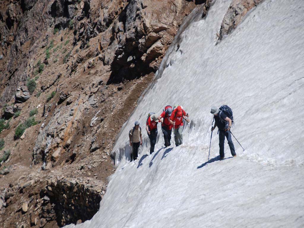
Day 5: Trek from Patharnachni to RoopKund 4920 mtrs and return from RoopKund to BhagwaBasa (14 Kms, 7 to 9 hrs), Overnight camping.Today we begin our toughest day as we will be climbing to the highest altitude along snow fields and then will be descending on the other side to our camp. We begin up a steep rocky trail that will lead us to Kalu Vinayak. The slope is quite tough and at this altitude is very demanding. All members are advised to walk slowly in order to avoid AMS and as always, stay hydrated. As we crest the top and come to Kalu Vinayak, we will be able to spot the Roopkund Lake crater for the first time. It can be seen in the distance across the mountain ridges ahead and serves to egg everyone forward. The Kalu Vinayak high point also has a shrine that, as per folklore, has always been present and was the spot where Lord Vinayak (Ganesha) stood as a standing guard so that nobody could move towards the lake while Goddess Parvati (Nanda Devi) took a bath in the lake on her way to Kailash. The trek leader blows the conch in homage to the Goddess and encourages all crew members to do the same before we carry on. This is also the point where the snowline begins and from here on, the temperature also usually dips as the wind picks up. We will trudge through the snow for about 1 kilometer till we reach the Bhagwabasa campsite below but instead of camping; we will proceed onwards and up towards the ridge above the Bhagwabasa camp that is the final ridge before Roopkund. (We will be camping at Bhagwabasa on our return) The area is buffeted by strong, chill winds and is known to have inclement weather, which can turn to snow or hail any month of the year and hence the climb up the ridge to Roopkund is quite a demanding one, through snow. The ascent is through a deep snow field with spectacular open vistas on both sides and the massive snow capped 7000 meter giants around you in close proximity. It is strongly advised to be cautious as you move along, since there are a couple of tricky sections where a mistake can prove to have serious consequences. After about a couple of hours, we will finally reach the Roopkund Lake and can see the eerie remains of bones and skulls of the infamous Roopkund legend, surrounding the beautiful lake that lies in a bowl with snow on all sides. We will spend some time and marvel at the beauty of the landscape, before grudgingly commencing our return journey. The return journey is by the same route as we walk carefully along the same ridge framed by the golden evening light as we wearily trudge our way down to the Bhagwabasa campsite for a well deserved rest!
Day 6: Trek from Bhagwabasa 4100 mtrs to Bedni Bugyal 3350 mtrs (8 Kms, 3 to 4 hrs),Overnight campingWe will begin early in the morning so that we can get past the unprotected Pathar Nachauni and Ghoda Lotani campsites before the weather changes (as it is known to in these parts). The start involved an initial ascent through snow till the Kalu Vinayak shrine where, as per tradition, the trek leader always blows the conch again on our way back. The return journey is pretty much the same, passing along the rocky trail till Ghoda Lotani after which we are back on the lush green meadows of Bedni Bugyal where we will camp for the night. If the weather is clear and we are lucky, we will catch one of the famous spectacular pink and purple sunsets over the spectacular snow peaks of Mt. Trishul.
Day 7: Trek from Bedni Bugyal to Wan Village 2540 mtrs (11 Kms, 3 to 4 hrs), Overnight CampingThe trek to Wan Village is largely downhill and takes us once again through the beautiful expanse of the lush green Bedni Bugyal meadow and then down into the thick oak forest. It is a very beautiful walk through the dark woods and the gentle slope and topography makes it possible to take a number of short cuts to make the journey more interesting and adventurous. You are also likely to come across shepherds with their flocks grazing at the lower altitudes. We will continue our descent till we reach the Neel Ganga which we will cross over via the iron bridge. On the other side, the trail starts to ascend till it reaches the ridge called Rann Ki Dhar which is the last point from where we will be able to see Mt. Trishul. Looking from here it is amazing to see the distance we have covered, from seeing it loom on the horizon at literally an arm’s length, to being far on the horizon within such a short span of time! We continue walking along the forest which has a mix of rhododendrons and is especially famous for its ancient centuries old Cypress trees with massive tree trunks with almost a 40 feet circumference! After a short while, we exit out of the forest and finally end up at the village of Wan where we will retire for the night. .
Day 8: Trek from Wan Village to Lohajung (14 Kms, 5 to 6 hrs), Overnight camping or stay in hotel/guest house at LohajungThe trek from Wan to Lohajung is an easy one and begins on a rocky rough path, parallel to the village. Keep your eyes peeled for a few beautiful waterfalls that we will see enroute as we keep moving along the road. You can also see colourful fields of Chaulai near Kulling village, with their red and purplish flowers standing out among the green of the hillside. We will continue along the rough road until after a while it becomes metallic and drivable. This is the main road connecting the villages of Wan and Lohajung and our trek ends finally at the main Lohajung stand where we will stay overnight before we head back to Nainital tomorrow.
Day 9: Drive from Lohajung to Nainital (203 Kms,5 to 7 hrs), Overnight stay in hotel at NainitalThe drive from Lohajung to Nainital is pretty much the same as the drive we had on the way in and we will take about 5-6 hours depending on traffic and road conditions.
Day 10: Drive from Nainital to Delhi (300 Kms, 7 to 8 hrs)The route from Nainital to Delhi is also the reverse of the journey we had on the first day and will be a long journey taking at least 7-8 hours till we are finally back in Delhi by evening.
