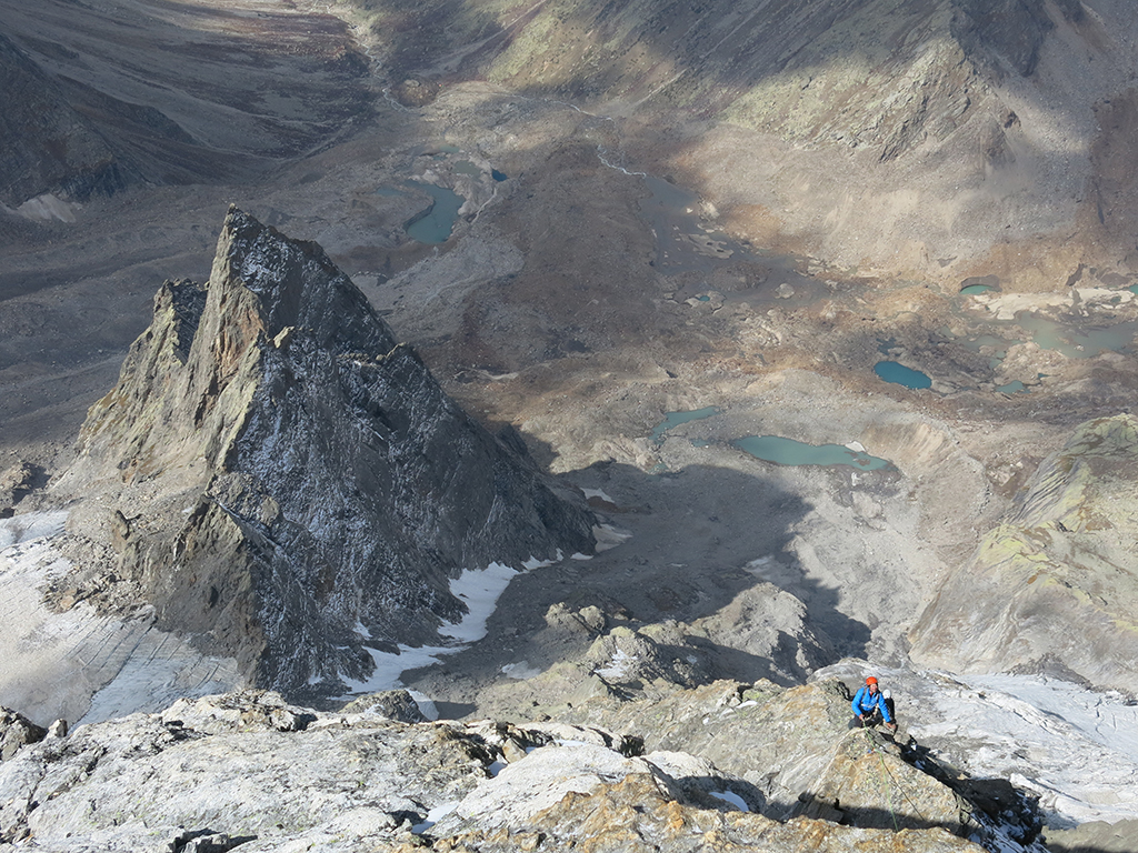
Chandratal Baralacha La Trek
Brief Description
Overview
Region: Kulu Spiti (Himachal Pradesh)
Trekking Altitude: Max (4950 mtrs)
Grade: Moderate
Total Trekking Distance: 48 Kms
Best Season: Jul to Mid Oct
Temperature Range: -5°C to 15°C.
Brief Information
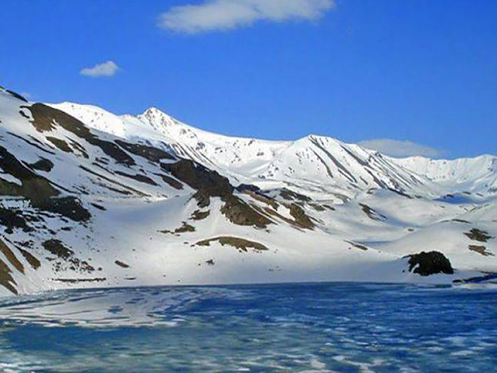
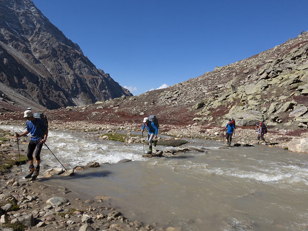
The trek from Chandratal to Baralacha pass is a moderate difficulty trek that takes one through a whole gamut of terrain and experiences. From the lush green, pine covered flanks of Manali with the playful wispy clouds to the rainshadow cold desert of Spiti and Lahaul with massive boulders, barren mountain slopes and gigantic hanging glaciers, the transition is abrupt and truly breathtaking. From the welcoming green of Manali that makes you feel at home, to the alien and forbidding aura of the barren desert that makes one feel insignificant, there is a whole gamut of emotions this trek will take you through. The high altitude will leave you gasping for air on most days and then amaze you with the spectacle that unfolds all around you – with fantastic lakes that change colour to raging, turbulent rapids, to multi coloured rocks and fossils, this trek indeed has it all. A word of caution though, even in summer, the Lahaul and Spiti valleys can get pretty cold with freezing winds whipping across and the altitude makes AMS a distinct possibility. Another aspect of the trek is the stream crossing – on numerous occasions you will have to wade through almost knee deep in the ice cold rapids that will threaten to sweep you away and will make every crossing feel like a thrill. Make no mistake this is a trek of a lifetime and will offer you views of so many snow capped peaks, that it will be impossible to count!
Short Itinerary
Day 1: Drive from Delhi to Chandigarh (250 Kms, 4 to 5 hrs), Overnight stay in hotel at Chandigarh
Day 2: Drive from Chandigarh to Manali (310 Kms, 7 to 9 hrs), Overnight stay in hotel at Manali
Day 3: Drive from Manali to Batal 3900mtrs (114 Kms, 3 to 4 hrs), Start trek to Chandratal4270mtrs (16 Kms, 6 to 7 hrs) (This distance can be travel by vehicle also), Overnight camping at Chandratal
Day 4: Trek from Chandratal to Tokpo Yongma 4420mtrs(13 Kms, 5 to 6 hrs), Overnight camping at Tokpo Yongma.
Day 5: Trek from Tokpo Yongma to Tokpo Gongma 4650mtrs(9 Kms, 4 to 5 hrs), Overnight camping at Gongma.
Day 6: Trek from Tokpo Gongma to Baralacha La4950mtrs(12 Kms, 5 to 6 hrs), Drive to Manali via Rohtang pass(199 Kms, 6 to 7 hrs), Overnight stay in hotel at Manali
Day 7: Drive from Manali to Chandigarh (310 Kms, 7 to 8 hrs), Overnight stay in hotel at Chandigarh
Day 8: Drive from Chandigarh to Delhi (250 Kms, 4 to 5 hrs)
Essential: Do's and Don't / Things to Bring / Inclusion and Exclusion (PDF)
Chandratal Baralacha La Trek - Fact and Info (PDF)
Chandratal Baralacha La Trek - Detailed Itinerary (PDF)
Fact & Info
INTERESTING FACTS/INFORMATION ABOUT THE PLACE
Chandigarh
Widely regarded as one of the most livable cities in India, Chandigarh is a planned city designed by the great French architect Le Corbusier. If possible, recommended detours are a quick drive around the landmarks of the city that showcase the amazing brutalist symbolic architecture, such as the Capitol Complex, Secretariat, Open Hand Monument and the High Court. Another amazing location worth visiting is the incredibly surreal Rock Garden Complex by Nek Chand. (and the very famous Sukhna lake situated in the heart of the city.)
Spiti Valley
The name Spiti can be translated as “The Middle Land” for it is the region that lied in between India and Tibet. Its ancient monasteries are a treasure trove of old Buddhist research and culture and has millennia old books that have been very well preserved, thanks to its extremely dry and cold climate. Among the many monasteries, the most famed are the Kyi (or Kii) monastery, which with its amazing cliff hugging design, is one of the most photographed; and the Tabo monastery, that is regarded as the Dalai Lama’s favorite. Among its sub-divisions, is the Pin Valley that due to its remoteness is the last sanctuary of the Buchen lamas of the Nyingmapa sect. The highest motorable pass is the Kunzum-La which, at 14,931 feet is the only access to the valley in winter, but can also get closed down for short periods of time due to snowfall. The valley is quite barren and tough to negotiate with an average height of 12,000 – 14,000 feet for most of its settlements.
Culture and LifestyleThe people of Spiti are Buddhist and their language belongs to the Tibetan language family. They used to practice polyandry but of late this is becoming rare with the advent of tourism and outside influences. The biggest festival is Losar (Tibetan new Year) and is celebrated with great joy during the months of either January or February, based on the “kaalachakra”, the Tibetan calendar. The villages are sparsely populated and the people here are hard working and practice potato farming or weaving. Owing to the harsh winters, the people still favour the nutritious salty butter tea and store dried meat for the long months with little or no access to greens. The houses are flat topped and built with a short squat profile, well spread out, since the region is prone to earthquakes. The design style is reminiscent of the Tibetan style and in places; you would be forgiven for thinking that post the Chinese invasion of Tibet, the true culture and Architecture of Tibet probably thrives here more as compared to Lhasa.
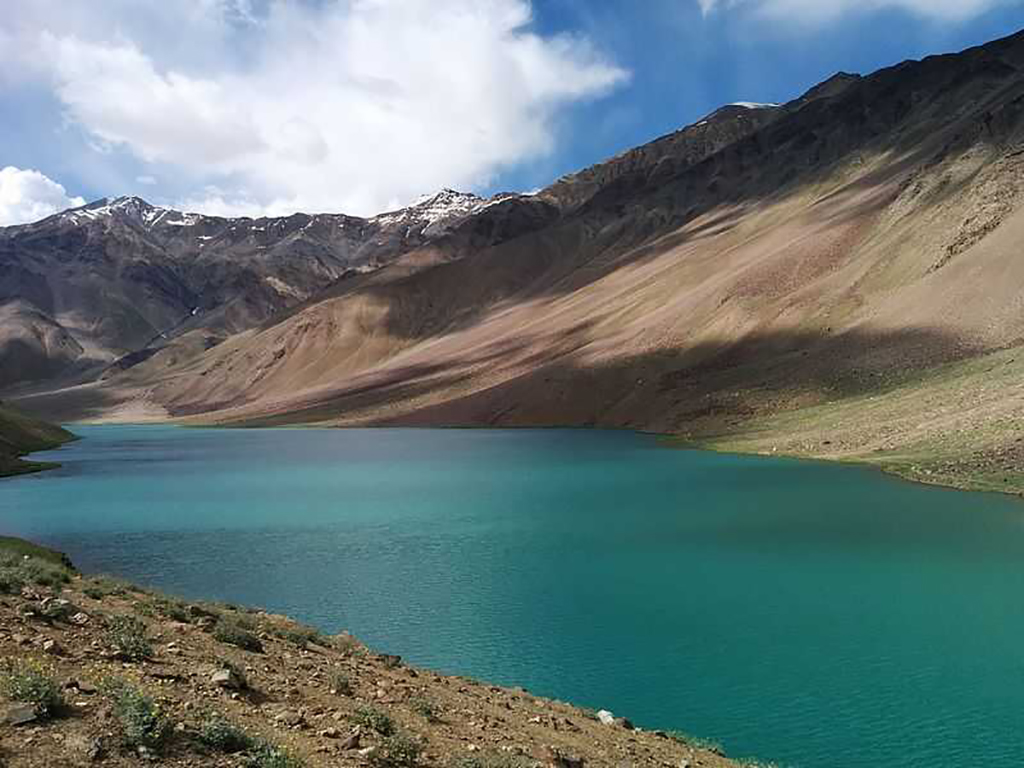
GeographyThere is some amazing natural topography in this seemingly barren land. While going further north of Kaza (the district headquarters) you will see fantastic mesas and fluted rock canyons that are an adventurer’s delight. If you take the trouble to go on down to the Spiti river bank, you will see some fantastic multi-coloured, perfectly round shaped pebbles on the river bed and by its sides. They are green, blue, pink, maroon, purple… all kinds of fantastic hues, indicating the rich mineral wealth of the region. There are also a couple of truly breath-taking lakes in the region – the Chandra-Tal (Moon Lake) that actually falls in Lahaul district but is approachable from Kunzum Pass. It is a divine looking crescent shaped lake with emerald blue waters that change colour throughout the day. The other less-visited lake nestled away in the mountains, is the Dhankar lake. This is approached via a day trek from the town of Dhankar, home to the famous Dhankar monastery. Adding adventure are the stark peaks that surround the valley, some of which are also trekking peaks and are a rewarding excursion on their own. The best example is Mt. Kanamo (19,500 feet) which is accessible from Kibber, where you can do a multi-stage trek upwards to the summit. Another exciting expedition is the Bara Shigri glacier that is the largest glacier in Himachal Pradesh, and also the second longest in India (after Gangotri) The Pin valley National Park that lies within Spiti is also the home of the elusive Snow leopard and the ibex and you can undertake expeditions set out to try and get a glimpse of the majestic creature.
BatalBatal lies at the banks of the Chandra River that gushes like an unstoppable beast and has probably the most dangerous rapids of the region. We will camp at the camping meadows close to the famous “Chandra Dhaba” that is run by the genial braveheart couple simply known as Chacha and Chachi (uncle / aunt) .They have been instrumental in saving numerous lives during whiteouts and landslides that occur so frequently in the region and have received national and state commendations for their deeds of bravery. Batal is famous for its wild, blustery high altitude winds as it lies in a channel between the mountain ranges cut by the flow of the river, creating a barren valley with rounded multi coloured boulders and pebbles of all sizes. You can get some stunning views of the mountain ranges lying in the Kullu region as well as the Lahaul region from here. Some of the most prominent peaks visible from here are the Papsura (White Sail) and Dharamsura. Completing the ring are the CB (Chandra Bhaga peaks) that tower over the camp. The camp site is also famous for spectacular star gazing since there is very little pollution here, being far away from civilization!
Lahaul ValleyThe Lahaul valley is the sister valley of Spiti and is very similar to it in many aspects with the same barren terrain and stark snow peaks only allowing hardy trees and bushes. The capital of Lahaul is Keylong which is an important town enroute to Ladakh. From Rohtang Pass, the road bifurcates with one form leading toward Spiti and the other leading towards Lahaul and then onto Ladakh. Lahaul has a number of virgin peaks and its peaks rise like silver steeples above the black, brown flanks of the mountains. The most prominent lakes in the valley are the Chandratal, the Suraj Tal (just below Baralacha Pass) and the Deepak Tal. These high altitude lakes are the most beautiful in India and are famed for their beauty and their ever changing blue colour that changes from turquoise to sapphire to aquamarine and all the shades in between as the sun moves across the sky. The valley is bounded by 2 high altitude passes, the Kunzum La that separates it from Spiti and the Baralacha La (the highest pass in the district) at an elevation of 16,040 feet. The Pass connects the Ladakh region with Lahaul and is covered by snow through most of the months of the year, surrounded by numerous mountain peaks and affording one of the most amazing panoramas of the region.
Kullu districtKullu is the prime administrative district in Himachal Pradesh and is also the most populous. The largest valley in the district is the Kullu valley (also known as the Valley of the Gods) where we have the famous hot springs of Bashisht and the popular tourist town of Manali. The northern border of the Kullu district is bounded by the Rohtang pass that is one of the most visited tourist destinations in the state. The river Beas is the primary river that flows through the district and most of the big towns such as Manali and Mandi lie along its banks.
Kullu valley/ManaliIt is a broad open valley famous for its sprawling apple orchards and the equally famous pashmina and angora shawls. The airport to access Manali town is located at Bhuntar near Kullu town, about an hour away (by car). The primary religion of people in the valley is Hinduism and there are many famous temples in the valley where people come from far and wide as pilgrimage.
A Brief HistoryKullu has been a prosperous and fertile valley since recorded history and has found mention in all the epics (Ramayana and Mahabharata) and the Puranas. In the later eras, a number of dynasties laid claim to the land, from the Nandas, to the Mauryas, to the Guptas, Palas and Karkotas. The region was later united by King Harshavardhana, but after his death, it again broke apart into small principalities, which were conquered by the Marathas and the Sikhs, before finally being annexed by the British. However, it remained fairly secluded until the construction of a motorable road only after Indian Independence, which meant that the people have retained their age-old customs and traditions, without being influenced or assimilated.
MythologyAccording to Hindu mythology, Kullu valley is regarded as the cradle of all mankind after the great deluge. The name “Manali” is derived from “Manu-alaya” that means the home of Manu, who is said to be the Hindu version of Noah, the progenitor of humanity. You will find the delightfully wood carved Manu temple a couple of kms above old Manali. Another story from the Mahabharata tells of Bheem, the strongest of the Pandavas, killing a demon terrorizing the area, “Hadimb” and then marrying his sister “Hadimba”. Their son, “Ghatotkacha” was one of the pivotal characters in the Great War against the Kauravas, sacrificing his life to make sure Arjuna would be invincible. The Hadimba temple, shrouded in dense pines on a hill above Old Manali is a beautiful multi-tiered wooden, pyramidal temple that was built to honour Hadimba devi. Legend also talks about “Arjuna Gupha”, a cave on the flanks of Mt. Deo Tibba, where Arjuna is said to have meditated in order to acquire the most destructive weapon, the Pashupati Astra from lord Indra.
Naggar palace
Naggar was the capital of Kullu for 1400 years and its 16th century wood and stone castle is exquisite and a must visit while in the area. There is a beautiful weeping willow in its central courtyard with lovely views of the snow capped mountains in the distance. Paintings by the German artist Nicholas Roerich, adorn the walls of the art gallery in the castle. There are also interesting ghost stories that are quite entertaining and worth listening to, especially on chill, winter nights. Most of the castle is now an exclusive heritage hotel.
Chandratal Baralacha La Trek - Fact and Info (PDF)
Detailed Itinerary
Day 1: Drive from Delhi to Chandigarh (250 Kms, 4 to 5 hrs), Overnight stay in hotel at Chandigarh
The very first day of what we are sure will be a memorable trip, starts with a round of introductions, after which we get into our vehicles for the drive from Delhi to Chandigarh. This is a pretty straightforward stretch, with the road being the usual city highway and we should be in Chandigarh by evening. If we reach early, it’s worth spending some time at the Nek Chand Rock Garden and later soaking in the night ambience of Sector 17. Tomorrow we will head into the hills and stay overnight at Manali.
Day 2: Drive from Chandigarh to Manali (310 Kms, 7 to 9 hrs), Overnight stay in hotel at Manali
The drive from Chandigarh to Manali is a long one that is flat in the beginning, but after a while it starts climbing up into the hills in a series of wide, sweeping turns and switchbacks. Once you reach Mandi, you can sense the beginning of the mountains with the River Beas rushing below the edge of the road and the turns ascending up along the jagged rock cliffs to the right. We will reach Manali by early evening (or late afternoon) and you can spend the time seeing the sights of the town, if you feel up to it or you could just walk down to the market and have an early dinner.
Day 3: Drive from Manali to Batal 3900 mtrs (114 Kms, 3 to 4 hrs), Start trek to Chandratal 4270 mtrs (16 Kms, 6 to 7 hrs) (This distance can be travel by vehicle also), Overnight camping at Chandratal
We drive up from Manali early in the morning to reach Batal as soon as possible. The road winds upwards, running parallel to the Beas for a while before it starts climbing towards the Rohtang Pass. The vista opens out as we get higher with lush green mountain sides dotted with dark pines and wisps of clouds swirling lazily through them. We will come across a thick glacial patch just a short while before we reach Rohtang Pass. The Pass is the highest point on the ridge and connects the valleys of Spiti, Lahaul and Kullu. On the other side of the pass, the difference of vegetation is obvious as we get lower with trees starting to thin out as the lofty snow peaks frame the dusty moonscape that we see far ahead in the distance on either side of the Chandra river that traces a deep gorge below. The road continues to go lower along switchbacks and the vegetation gets sparse as we go along.
While on our journey down from Rohtang pass, we will come across a couple of typically tricky sectors where the road always gets washed away due to the force of the gushing glacial streams crossing the road as they fall down the mountain side. These streams move with considerable force later in the day.Thus the chances of a vehicle getting stuck between the rocks while trying to pass through increases as the sun gets higher in the sky due to the ice melt rate speeding up. If we are unfortunate to be stuck behind any vehicle that gets stuck at such a sector, the resulting traffic pile up on either side can cause unforeseen delays. Another notorious sector is about 10 kms before Batal along the banks of the Chandra river where the stream is larger than the first instance that occurs about an hour after crossing Rohtang and just before Chhatru. It is a good thing though that we get down and wade in here as it gives us time to admire the spectacle of the stunning and massive Bara Shigri glacier on our right that comes down in an intimidating ice fall all the way from the peaks till almost to the river bank.
After braving the rough drive through the rocks, undulating roads and wading through the freezing glacial streams, we finally arrive at the campsite of Batal, a green patch surrounded by towering mountains on all sides with the turbulent Chandra river flowing along the valley. Batal is a fantastic campsite with vast fields of multicoloured stones and pebbles surrounding a small meadowland of bright yellow flowers with a glacial stream running through it.
While the distance between Manali and Chandratal can indeed be driven, it is much more exciting to experience the terrain while hiking it out. However, it is possible that we might have to drive if we get delayed arriving at Batal.
If we reach Batal by afternoon, we can quickly settle in, have lunch and begin our trek to Chandratal. Batal is at a fairly high altitude and is windy, chilly and dry, so there is a possibility of some members feeling the effects of mild AMS. All members are advised to carry bottles of water and walk very slowly with minimal effort, in order to avoid aggravating the AMS effects. While those with AMS could go to the lake via a vehicle, we would recommend trying to hike it slowly till the lake since the trek to Baralacha after Chandratal is going to take us to higher altitudes and it will be very difficult to acclimatize later.
The trek begins from the Batal campsite and crosses over the bridge, past Chacha ka Dhaba and the small temple. On the right you will be able to see the steep peak of Papsura rising steeply into the sky, flanked by its cousin Dharamsura and a whole host of spectacular peaks of the CB(Chandra Bhaga) range. The walk is along the road that leads on towards Kunzum La and into Kaza further on, but we will take the road going left at the fork about 2.5 kms ahead. The route has slight ascents and descents but is largely level with an overall gradual descent till we reach the level of the river. The panorama is truly breathtaking with the rare vehicle passing by, while the surrounding feels like a huge painting, with the river Chandra making wide channels below interspersed with mud islands.To our right and left stand lofty snow peaks with flanks covered in yellow wildflowers and bright green grass.
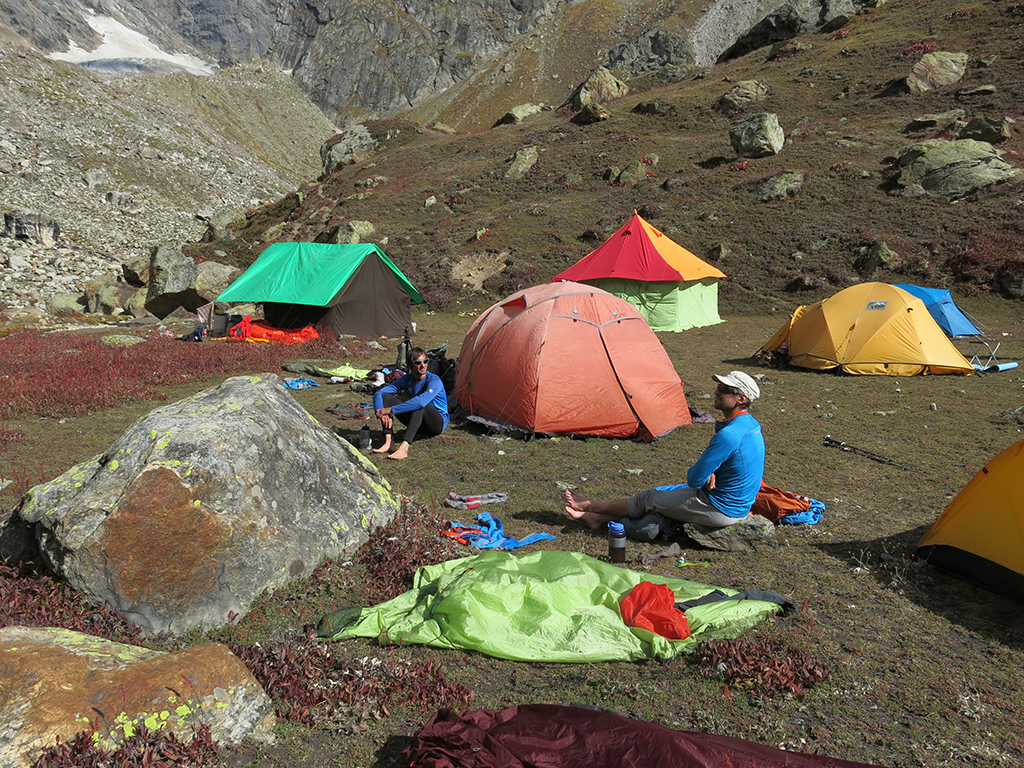
After a few hours of walking we will come across a wide gushing glacial stream as the road takes a left. This is when we know the lake is not far away. After a couple of kms as we turn along with the road, we can see probably the most majestic of the CB peaks – the CB 14 with its gigantic hanging glacier to our left and a series of camps on a bright green meadow that leads down to the river. This will be our camp for the night. The actual lake lies another 1-2 kms ahead just beyond the hill that lies behind the camp. We will unload our things here and then rush to get a glimpse of the incredible lake.
The climb up the hill is much tougher than it looks owing to the high altitude and we walk through the beautiful green grass and flowers. Once we cross the lip of the rise, we need to walk on a bit further along a trail before we finally sight the elusive moon lake, looking like a sapphire dropped miraculously into the middle of brown/grey barren peaks. An incredible feature of the lake is its beautiful, soft white sand beach and the colour of the water that changes throughout the day.
(Please be careful not to venture out into the lake as it is said to be quite deep and dangerous, especially for non swimmers)
After a quick visit to the lake shores, we will walk back to the camp, and watch the brilliant star studded night sky.
Day 4: Trek from Chandratal to Tokpo Yongma 4420 mtrs(13 Kms, 5 to 6 hrs), Overnight camping at Tokpo Yongma.
Today we will begin early in the morning back up to the lake to spend some time at the lake and appreciate the beautiful sunrise and the incredible blue colour of the lake that will be a new shade of from what we saw yesterday evening! After spending some time here, we will go back to the campsite, have breakfast and then begin our trek.
The path by itself is pretty simple and we will constantly be keeping company with the barren snow covered peaks on both sides as we walk along the true left bank of the river climbing and skirting past the boulders enroute. We will need to take off our boots and cross the stream a few times and also move to the other side of the river which is where our camp will be. Please note that the river is fairly deep and as the day wears on, it gets deeper and rougher, so caution is advised while crossing it.
It is also very important to walk slowly and stay hydrated since we will be ascending today. Luckily the ascent is not too difficult giving us ample time to take in the sheer size and scale of the mountains in the Lahaul Spiti region.
After 5-6 hours, we will finally end up at the camp site of Tokpo Yongma. The campsite as such is pretty similar to the terrain around except for the breathtaking views of the Mulkilla range of peaks. These peaks are a cluster of fantastically shaped spires that seem to have forcibly thrust out of the ground like needles. They are technical in nature and notoriously difficult to climb and include in their midst, a number of virgin peaks.
Day 5: Trek from Tokpo Yongma to Tokpo Gongma 4650 mtrs (9 Kms, 4 to 5 hrs), Overnight camping at Gongma.
Today we need to leave as early as possible, even at 5-6 am if all members can make it, simply because there are 2 stream crossings of which the 2nd isn’t exactly a stream, it is a wide river! As has been said before, it is always much easier to cross in the mornings, hence it will help if we can begin our day quickly in order to avoid any possibility of mishap or injury later.
The first stream crossing is reasonably easy after which it is back to the usual rocky terrain with the magnificent moonscape all around. As we come to the second crossing,you will see that this is a river and is quite tricky to cross. The usual route is across a snow/ice bridge that is a bit further along the obvious crossing point. This snow bridge also needs to be crossed carefully, watching out for any cracks and taking care over the slippery ice.
Once we are on the other side, we need to walk along by the side as soon as possible to avoid rock falls which increase as the temperature gets hotter. Once this sector is passed, it is a fairly level walk for a while before the final steep ascent traversing a tricky scree slope which finally brings us to the beautiful campsite with its stretch of grass and wildflowers that feels like an oasis in the middle of the cold desert! We will camp here for the night, but participants who are not too tired may attempt to walk up the sides of the mountains fringing the campsite in order to acclimatize as well as to look for fantastic panoramas of the beautiful peaks that is a rare view since this trek is not one of the popular treks that people undertake, which is unfortunate.
Day 6: Trek from Tokpo Gongma to Baralacha La 4950 mtrs(12 Kms, 5 to 6 hrs), Drive to Manali via Rohtang pass (199 Kms, 6 to 7 hrs), Overnight stay in hotel at Manali
We will again need to wake up very early in the morning since we have a long day ahead of us with a fairly long drive to Manali coming up. The walk by itself is not very difficult with gradual ascents and a few gentle descents until we again have to cross a stream where we will again wade through. On the other side, the walk is again fairly easy with only a couple more smallish streams enroute.
The most amazing thing about the trek today is the spectacular views that surround us. We are literally on a high plateau in the middle of the Great Himalayan ranges, surrounded by a huge array of peaks in every direction. We will make the final climb up to Baralacha La and enjoy the magnificent vista one final time before we get into the vehicle that will take us back to Manali over the Rohtang Pass. While on our way back, we will stop for a while just after Baralacha Pass and walk down to Suraj Tal that is another fantastic high altitude lake similar to Chandra Tal, except that it is a bit larger and oval in shape. The glaciers here are the source of the river Bhaga that joins the Chandra river later to form the Chenab river.
If we reach Manali early, we can either try to visit the Bashisht hot springs or the Naggar Palace before we check into our hotel.
Day 7: Drive from Manali to Chandigarh (310 Kms, 7 to 8 hrs), Overnight stay in hotel at Chandigarh
Today early morning, we will need to get refreshed and packed for the long drive to Chandigarh. This is a fairly easy drive with the only tricky sector being the winding roads from Mandi to Chandigarh. We will halt at Chandigarh tonight and explore the famous landmarks around the city such as the Nek Chand Rock Garden or the Secretariat, and end the evening with a leisurely stroll along Sector 17.
Day 8: Drive from Chandigarh to Delhi (250 Kms, 4 to 5 hrs)
The drive from Chandigarh to Delhi is straightforward and should have us safely at the capital city in 4-5 hours.
