Dodi tal Trek
Brief Description
Overview
Region: Garhwal, Uttarakhand
Trekking Altitude: Max (4180 mtrs)
Grade: Easy upto Dodital and moderate from Dodital to Sangamchatti.
Total Trekking Distance: 56 Kms
Best Season: April to November. The avid trekkers can also go for winter trekking on this trail.(In winters this trek can be undertaken up to Dodital only) Road to Yamnotri/Hanumanchatti closes after Month of Nov and opens in Apr/May.
Temperature Range: -3°C to 17°C.
Brief Information
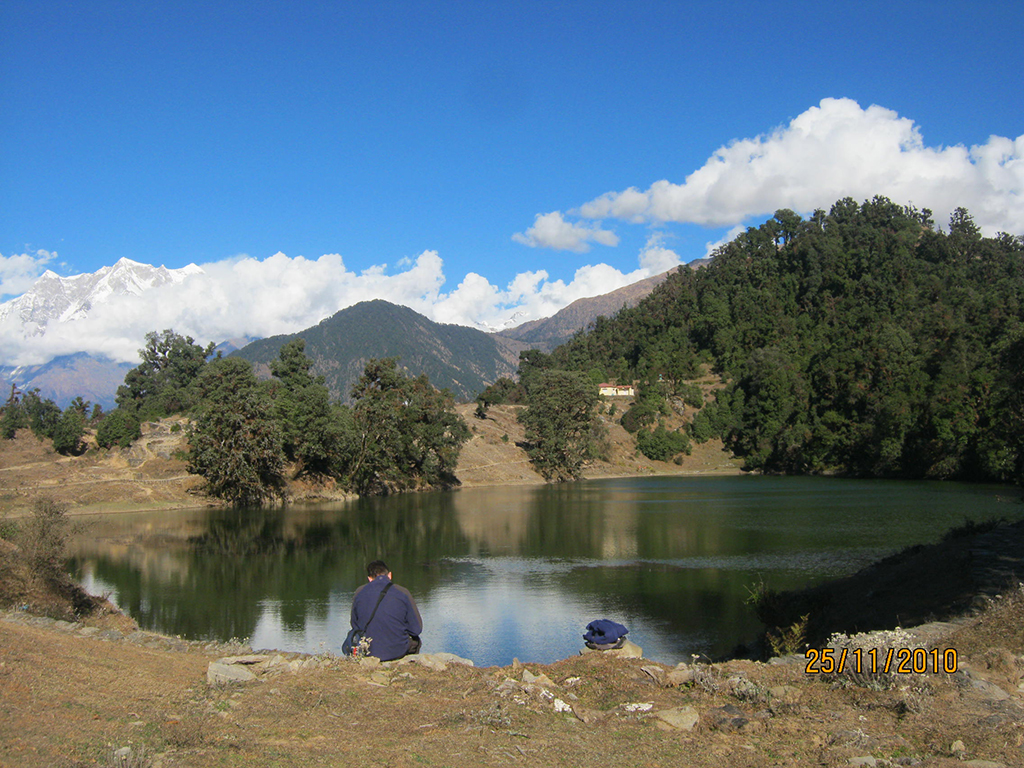
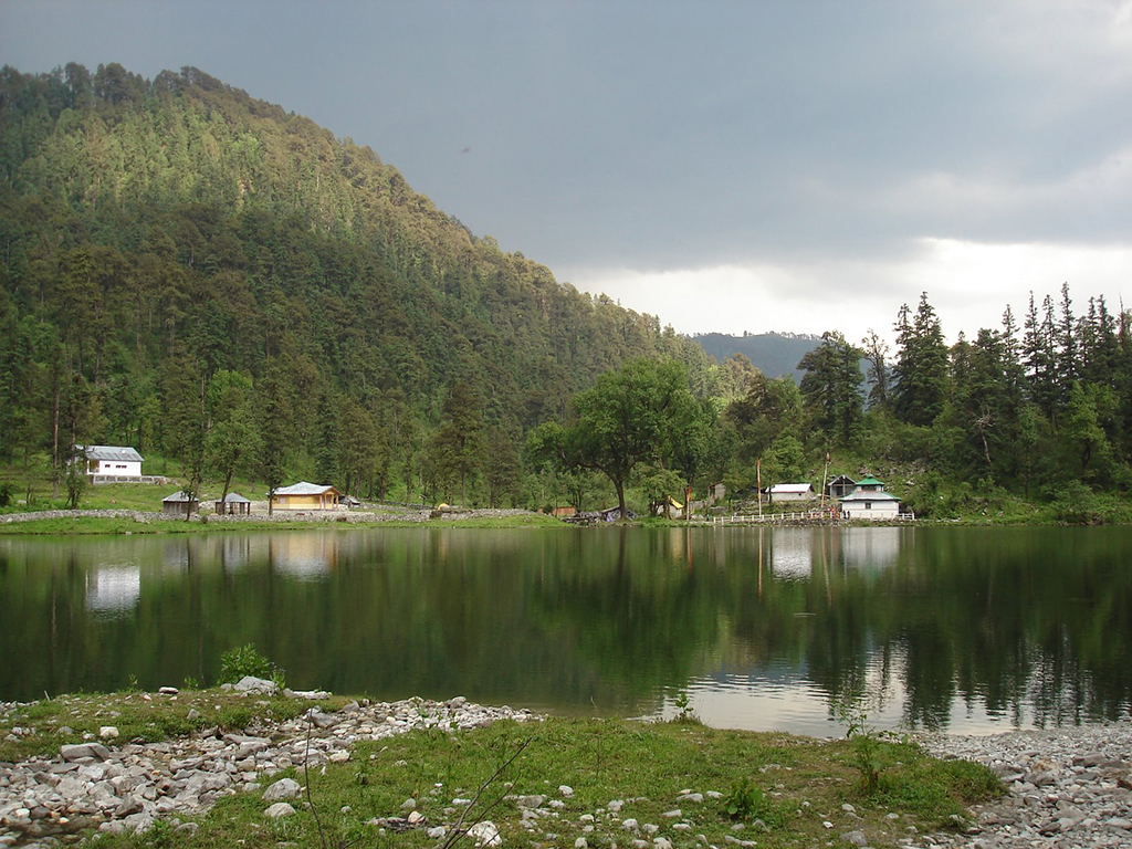
Dodital is a high altitude lake in the North Western Garhwal Himalayas that lies close to the westernmost “Dham” of the Char Dham yatra – “Yamunotri”. The trek to Dodital is fairly easy and is suitable for all kind of trekkers, including first timers. A few trekkers extend the trek all the way to Yamunotri or even Bandarpoonch Base Camp, but this is not possible in winter due to accumulation of snow. The highlights of this trek are the undulating alpine meadows framed by exquisite views of the Gangotri range of the Garhwal Himalayas and the Dhauladhars that look close enough to touch! The trek gives unparalleled views of the Swargarohini and the Bandarpoonch mountains that can rarely be enjoyed from any other vantage point. The name Dodital is derived from the local name of a rare Himalayan trout that is found only in this lake, along with the more common brown trout. The lake is surrounded by dense forests of pine, oak, rhododendrons and deodar. It also holds the distinction of being a transit point by sadhus and trekkers undertaking the pilgrim march from Gangotri to Yamunotri. Nomadic herdsmen known as gujjars also hike along the trail regularly for grazing their cattle. The lake is famous in Hindu mythology as the birthplace of Lord Ganesha, who made it his abode and there is a temple dedicated to him at the lake. This is also the reason it is alternatively known as Dhundital, which translates to being the Lake of Ganesha in the local dialect. The lake is also believed to be the source of the river “Assi Ganga”.
Short Itinerary
Day 1: Drive from Delhi to Rishikesh (250 Kms, 5 to 7 hrs), Overnight stay in hotel at Rishikesh
Day 2: Drive from Rishikesh to Uttarkashi and further to Sangam Chatti (186 Kms, 6 to 7 hrs), Overnight Camping
Day 3: : Trek from Sangam Chatti 1350 mtrs to Agora 2250 mtrs(6 Kms, 3 to 4 hrs), Overnight Camping
Day 4: Trek from Agora to Dodital lake 3310mtrs (16 Kms, 6 to 8 hrs), Overnight Camping
Day 5: Explore Dodital lake with a periphery of 1.6 Kms and rest day for angling & sightseeing, Overnight Camping
Day 6: Trek from Dodital lake to Darwa Top 4180mtrs and further to Seema 3450 mtrs(16 Kms, 7 to 8 hrs), Overnight Camping
Day 7: Trek from Seema to Hanuman Chatti 2400mtrs (18 Kms, 5 to 6 hrs), Overnight Camping
Day 8: Drive from Hanuman Chatti to Rishikesh (285 Kms, 7 to 8 hrs), Overnight stay in hotel at Rishikesh
Day 6: Drive from Rishikesh to New Delhi (250 Kms, 5 to 7 hrs).
Essential: Do's and Don't / Things to Bring / Inclusion and Exclusion (PDF)
Dodi Tal Trek - Fact and Info (PDF)
Dodi Tal Trek - Detailed Itinerary (PDF)
Fact & Info
INTERESTING FACTS/INFORMATION ABOUT THE PLACE
Uttarkashi
Uttarkashi town is the district headquarters of Uttarkashi and is situated along the banks of the river Bhagirathi. It is well known for its ashrams and temples and also because it is home to one of the best Mountaineering Institutes in India – the Nehru Institute of mountaineering. It was named as Uttarkashi (The Kashi or Varanasi of the North) since its topography and location along the banks of the Bhagirathi bears close resemblance to the city of Varanasi that lies along the river Ganga. Uttarkashi is very famous among adventure enthusiasts as it offers white water rafting along with some excellent trekking routes and mountaineering expeditions into the Gangotri region. Uttarkashi is also the site of a couple of hydro electric power project Tiloth Power Plant dams, Maneri Dam and Bhali Dam in Joshiyari village. Uttarkashi is also the biggest town and main centre for trekking supplies and guides for all treks going into the Gangotri and Yamunotri regions.
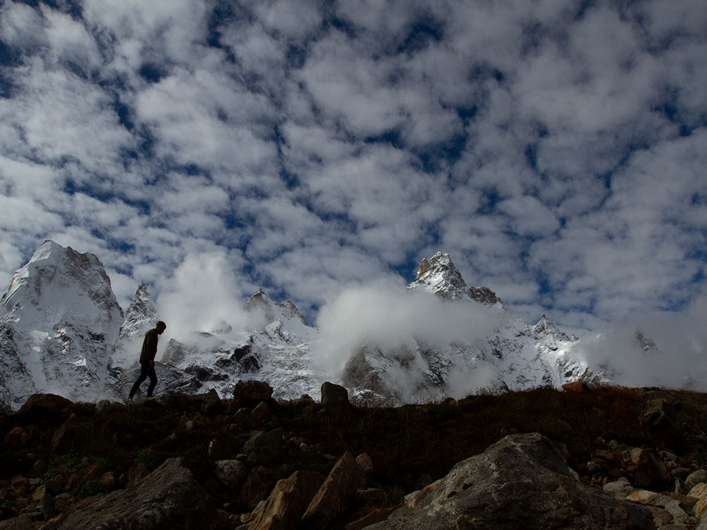
Darwa TopA steep ascent from Dodital takes one to Darwa Pass, from where yet another steep walk takes you to Darwa Top (at 4,180 metres) The peaks visible from here are the Gangotri range, with the most notable being Swargarohini, Bandarpoonch and Hanuman Tibba (which lies in Himachal Pradesh).
YamunotriThe source of the river Yamuna lies atop a flank of Bandarpoonch mountain at an altitude of 3,293 metres, in the westernmost Garhwal Himalayas. It is also regarded as the seat of Goddess Yamuna and the shrine is named as Yamunotri in her honour. It is a popular pilgrimage location and one of the most important “char dhams” of Hindu Pilgrimage. It is located about 30 kms North of Uttarkashi. The actual source of the river is the Champasar Glacier that is located on the Kalind Mountain 1 km away from the shrine and almost 500 metres above! (at 4,421 metres). The approach is extremely difficult and dangerous and it is regarded as inaccessible. The deity of the temple is made of black marble and was placed by Maharaja Pratap Shah of Tehri Garhwal. There are number of hot springs gushing out of the cracks in the mountains here, which pool and form steaming ponds (or “kunds”). The most important among these is the Surya Kund. Hot springs are also found about 7 kms away at a place known as Janki Chatti. The temple closes for winter on Diwali day and reopens in summer on the auspicious day of Akshaya Tritiya.
Janki ChattiJanki Chatti is a small town about 3 Kms prior to the Yamunotri temple located at an altitude of 2650 metres above sea level. It is the base for all pilgrims and trekkers travelling to Yamunotri since it provides accommodation facilities and is the last village on the route. The village has a number of hot springs where pilgrims and trekkers can have a prolonged bath and rejuvenate themselves.
Sangam ChattiSangam Chatti is a typical nondescript town in the Garhwal highlands located at an altitude of 1,350 metres above sea level. Its claim to fame lies in the fact that it is the last motorable point for the trek that leads onto Dodital.
Saptarishi KundSaptarishi Kund is the source of the river Yamuna and is located about 8 kms above the Yamunotri shrine. It lies at the foot of the Champasar glacier and the trek to reach it is a steep and challenging journey over moraine and boulders with steep rock walls that would be a tough climb ever for experienced trekkers. There are a couple of glacial ponds here and a pass can be viewed beyond Champasar glacier that leads to the Bandarpoonch glacier.
The Bugyals of UttarakhandThe Bugyals (or high altitude alpine meadows ranging between approximately 9,000 to 11,000 feet) of Uttarakhand are large gently sloping verdant summer grasslands that turn into superb ski slopes during winter. They are some of the most beautiful spots in the mountains, with their beauty rivaling the meadows of the Austrian, Swiss and Italian Alps. Some of the most famous bugyals are the Auli Bugyal (that is the primary ski resort of Uttarakhand), the Bedni Bugyal which is part of the route that leads onto RoopKund lake and the Dayara Bugyal that along with the Barnala Bugyal is a huge meadow with spectacular views of the Gangotri peaks.
Dodi Tal Trek - Fact and Info (PDF)
Detailed Itinerary
Day 1: Drive from Delhi to Rishikesh (250 Kms, 5 to 7 hrs), Overnight stay in hotel at Rishikesh
We meet in Delhi and begin our drive as early as possible, so that there is some time to explore Rishikesh in the evening. The drive by itself is unspectacular until we come across the holy ghats of Haridwar where we will skirt the wide and swift flowing river Ganga. From this point on, the road gets more interesting with a climb up the wooded foothills of Rishikesh, passing by the various Yoga ashrams and retreats that Rishikesh is known for.
Check-in to the hotel and venture out in the evening along the banks of the river Ganga, or enjoy a walk along the Laxman and Ram Jhula, the famous suspension bridges of Rishikesh.
Day 2: Drive from Rishikesh to Uttarkashi and further to Sangam Chatti(186 Kms, 6 to 7 hrs), Overnight camping
The drive from Rishikesh to Uttarkashi goes through the towns of Narendra Nagar, Mohan Chatti, Tehri, Chamba and Chham. Most of the road is narrow and is pretty much a constant climb. From Uttarkashi, we need to the take the road going left, parallel to the Assi Ganga river for a little more than 16 kms across bumpy roads, till you finally reach the small town of Sangam Chatti. This is the end of the motorable road and we will begin our trek from here tomorrow morning.
Day 3: Trek from Sangam Chatti1350 mtrs to Agora 2250 mtrs(6 Kms, 3 to 4 hrs), Overnight campingThe trek begins today with an easy gradual climb along a well paved stony trail through the pine forest, once we cross the wooden bridge. After a while you will see the trail forking away with the ascent leading towards Barkoli village. We take the descending arm of the fork for a short while before it again starts ascending in a series of switchbacks. As you crest the rise, you will need to walk about half an hour before you can see our destination Agora village, in the distance with the snow clad mountains in the background. In the foreground lies the village of Dundkhola,that we will cross first. After a short while of walking beyond the Dundkhola village, we finally arrive at our destination, which caps the end of an easy first day trek. We can spend some time exploring the surroundings and getting acclimatized for the upcoming days. The region also has a fair number of birds and butterflies and they present some lovely photo opportunities.
Day 4: Trek from Agora to Dodital lake3310mtrs (16 Kms, 6 to 8 hrs), Overnight CampingThe trek from Agora begins along a well-marked stone trail with stone staircases and side barricades along narrow paths. To our side we can see the deep river gorge of the Assi Ganga as we move along, hugging the mountain side. We will reach the village of Bevra after a gradual descent to and across the river. The village has a restaurant and cafes with adjoining campsites. We can replenish our water stocks and then proceed up the ridge that lies in front of us. As we get higher, we can now see Agora village directly at the back on the opposite side, receding away. We continue to walk through the Pine and Deodar forests until we turn sharply to the left and finally crest the ridge after a steep ascent. As we walk on along the ridge, we will come across a shelter from where we can see the famous Bakaria Top that marks the highest point of the beautiful Dayara Bugyal. For those intending to cover Dodital and Dayara Bugyal in one trek, this is where they can branch off on their way back from Dodital. From this shelter, Dodital is 10 kms away, while halfway (at 5 kms) lies the clearing of Manjhi. The trail which was hugging the mountain side and the river gorge, will now enter a dense covered thicket of rhododendrons and pines which means you are likely to find patches of snow here in summers and deep snow in winters! After a further hour and a half of gradual ascents up the mountainside, we will come across a fork in the trail with the left angling upwards sharply. This is the way to Manjhi and after a short sharp climb, we will be able to see a cluster of shepherd huts spread out all over the slope under the oak trees. From Manjhi, the trail to Dodital is on the right and is largely a level walk, with a few ascents, as you traverse the mountain slopes from one ridge to the other. The forest thins out as you get higher and we skirt a small shrine to come across a stream running across largely level ground. We are now very close to Dodital and this is the stream that leads out from the lake itself. A short walk later, we finally arrive at Dodital that has a few shepherd huts and temples along a large open clearing. This is Dodital and you can see the beautiful lake awaiting you as we finally break for the day. In winters the trek is much more difficult as most of the sector we have done is through snow that can be as deep as 1-2 feet deep, multiplying the difficulty level exponentially.
Day 5: Explore Dodital lake with a periphery of 1.6 Kms and rest day for angling & sightseeing. Overnight CampingToday we will take it easy and explore the lake by walking along its periphery. The complete “parikrama” (circumambulation) is only 1.5 kms and we can do it at a leisurely pace and enjoy the serenity and beauty. For the anglers among us, we can spend a comfortable day along the banks of the river, angling for the rare and incredible Dodi (Himalayan Trout). Since it is rare and protected, the trout needs to be released back into the waters and this should be followed strictly by all members. Time spent at the lake is incomplete without visiting the temple of the presiding deity of the lake, Lord Ganesha. This is an ancient temple and while it is opens during summers, heavy snowfall in winter causes it to be shut.
Day 6: Trek from Dodital lake to Darwa Top4180mtrs and further to Seema3450 mtrs(16 Kms, 7 to 8 hrs), Overnight CampingWe will begin early in the morning since it is a long and tough trek today. The slope and ridge that we see from Dodital camp is the route up to Darwa Pass and it is a fairly steep climb that takes us up to the pass which lies at approximately 3800 mteres. From here another steep climb will take you to Darwa Top, at 4,180 metres, where exhausted, we enjoy the 360 degree panorama rewards of our hard work – the stunning vista of Bandarpoonch, and its partner Gangotri range of peaks. It is worth noting here that Darwa Pass and Darwa Top are usually covered with snow fields throughout the year and walking along here will be slow and more difficult than usual. From Darwa Top, the trail will now continue up and down along rolling slopes, enjoying the spectacular views of the Gangotri range, with even Nanda Devi visible on a clear day! After about an hour and a half of walking, we finally come across to the meadows of Seema where we will be camping for the night.
Day 7: Trek from Seema to Hanuman Chatti2400mtrs (18 Kms, 5 to 6 hrs), Overnight CampingThe trek from Seema to Hanuman Chatti is downhill with the trail till Kandoli passing through undulating, beautiful alpine meadows sprinkled with wildflowers and the mesmerizing snow peaks paralleling us all the way along the horizon. From Kandoli, the trail enters a thick oak and rhododendron forest and is much steeper as it descends dramatically to the town of Hanuma Chatti (2400 metres) after about a total of 3-4 hours of constant walking. We will be camping here, signaling the end of a long and amazing trek covering meadows, snow, a sacred lake and temple and of course the spell binding Himalayan peaks at arm’s length away!
Day 8: Drive from Hanuman Chatti to Rishikesh (285 Kms, 7 to 8 hrs), Overnight stay in hotel at RishikeshThe drive from Hanuman Chatti to Rishikesh is down the slopes along rough roads passing Barkot till we reach the junction of Dharasu from where it is the same route that we came up by, passing through Tehri till we reach Rishikesh after a long 7-8 hours drive.
Day 9: Drive from Rishikesh to New Delhi (250 Kms, 5 to 7 hrs)From Rishikesh to Haridwar, we descend along forested slopes, paralleling the river Ganga. The drive from Haridwar onwards to New Delhi is through the plains via Roorkee, Meerut and Ghaziabad and is almost an anti-climax after the beautiful time spent amidst the sublime Himalayan beauty.


