Har ki Dun Trek
Brief Description
Overview
Region: Uttarkashi District (Uttarakhand)
Trekking Altitude: Max(3540 mtrs)
Grade: Easy
Total Trekking Distance: 46 Kms
Best Season: April to June and September to December
Temperature Range: -2°C to 22°C.
Brief Information
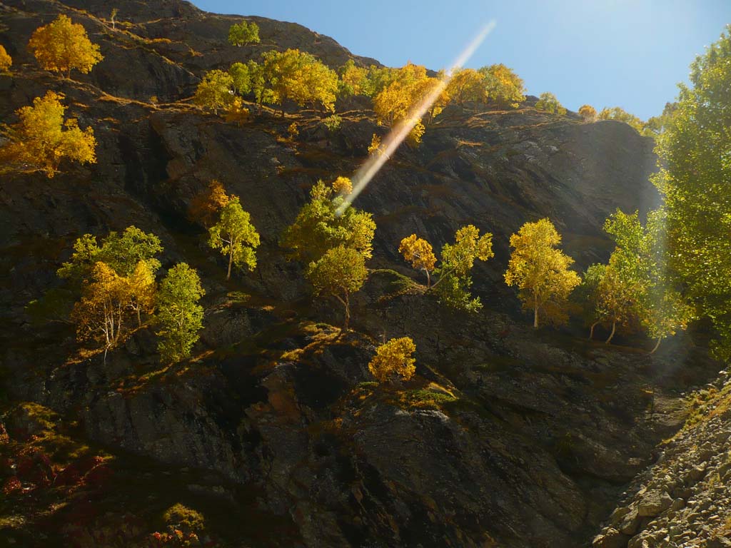
Har Ki Dun (translated as the Valley of the Gods) Trek is a beautiful and fairly easy trek in Uttarakhand. It lies within the Govind Pashu Vihar wildlife Sanctuary and is at an altitude of 3566 metres above sea level. The trek is a veritable paradise for bird and wildlife watchers, being unspoiled and remote, and has an impressive variety of vegetation on display, with trees such as chestnut, walnut, willow and chinar flourishing in abundance. The locals believe that a teacher at the Doon School, Jack Gibson, rediscovered this remote route to the valley and made it a popular trekking destination among his students and friends. The highlight of the trek is an unparalleled view of the Swargarohini massif with all its peaks (Swargarohini I, II, III and IV) arrayed in a semi circle at the end of this U shaped valley, along with the accompanying peaks of the Bandar Poonch and Kala Naag; all giants standing tall, dwarfing the sky. At the valley itself, there are a couple of amazingly beautiful treks. That is a fantastic bonus! You can go to either the Maninda Taal (lake) which is about 10 kms away or to the picturesque Jaundhar glacier that is about 5 kms away. As per the Hindu epics, the Swargarohini range is famous for being the mountain from where the Pandavas are said to have ascended to heaven after the great Mahabharata war was over, hence the name “Swargarohini” which means “Ascent to Heaven”. Probably the other interesting feature of the trek is the intricately carved and ingenious wooden houses of the locals who have carried on the millennia old traditional style of construction and way of life, still totally dependent on farming and livestock, owing to the remoteness of the villages along this route which ensures outside influence almost non-existent (other than the trekkers who come by). Another unique aspect of the culture and architecture buffs is the beautiful temple (and the only one!) dedicated to Duryodhana, the Kaurava King, which is because the locals here have believe they are the descendents of the Kauravas.
Short Itinerary
Day 1: Drive from Delhi to Mussoorie (275 kms 7 to 8 hrs), Overnight stay in hotel at Mussoorie.
Day 2: Drive from Mussoorie to Sankri 1830 mtrs (160, 5 to 6 hrs), Overnight stay in guest house at Sankri.
Day 3: Drive from Sankri 1830 mtrs to Taluka 1950 mtrs (12 Kms, 40 mins) and trek to Osla 2560 mtrs (12 Kms, 5 to 6 hrs), Overnight Camping at Osla
Day 4: Trek from Osla 2560 mtrs to Har Ki Dun 3540 mtrs (11 Kms, 6 to 7 hrs), Overnight Camping at Har ki Dun.
Day 5: Trek from Har Ki Dun to Osla (11 Kms, 4 to 5 hrs), Overnight Camping at Osla.
Day 6: Trek from Osla to Taluka (12 Kms, 4 to 5 hrs) and then drive to Mussoorie (172 Kms, 5 to 6 hrs), Overnight stay in hotel at Mussoorie.
Day 7: Drive from Mussoorie to Delhi (275 Kms, 7 to 8 hrs)
Essential: Do's and Don't / Things to Bring / Inclusion and Exclusion (PDF)
Har ki Dun Trek - Fact and Info (PDF)
Har ki Dun Trek - Detailed Itinerary (PDF)
Fact & Info
INTERESTING FACTS/INFORMATION ABOUT THE PLACE
Mussoorie
Mussoorie is 35 kms away from Dehradun lying on a ridge at an average altitude of 6,580 feet. The highest point is lal Tibba at 7,500 feet where you can get an uninterrupted view of the Doon valley and the Shivalik ranges to the south. There are a number of places of historic importance as well as natural beauty worth visiting, such as the Gun Hill, the Kempty Falls, St Mary’s church (the oldest Christian church in the Himalayas) and Sir George Everest’s House and Loaboratory.
DhanaultiDhanaulti is a popular hill station located 24 kms away from Mussoorie and is a very popular destination for tourists from the plains, with its verdant forests of oak, Deodar and rhododendron. It is famed for its panoramic view of the Garhwal Himalayas early in the morning on a clear sky, spreading all the way across the horizon.
The Swargarohini Range and LegendAs per the Mahabharata legend, after the Great War was over, the Pandavas racked with guilt over the slaying of their cousins, decided to do penance and seek absolution. They renounced their worldly trappings and moved into the forests of Uttarakhand, finding the path to ascend to heaven and be rid of the cycle of rebirths. Enroute, feeling thirsty, they came across a lake guarded by a Vaksha, who warned the brothers that they would die if they drank the water unless they answered his questions. All the brothers died by ignoring his warnings except for the eldest “Yudhishthira”. Yudhishthira, the wisest of them all, listened to the questions and answered them all satisfactorily, and was allowed further progress up the mountain to ascend to heaven. The mountain path that he took on his ascent to heaven was along the Swargarohini range massif, which is why this group of 4 peaks is immortalized and revered in Hindu mythology.
Ruinsara TalRuinsara Tal is a beautiful high altitude glacial lake lying at the foothills of the Swargarohini massif. The lake lies in a huge open meadow surrounded by forested ridges and massive looming peaks around it. It is usually clubbed in with a trek to the Bali Pass, a lesser known but spectacular Pass that takes one up, close and personal with the Swargarohini peaks.
Borasu PassBorasu Pass lies at 5450 metres above sea level and is part of the ancient trade route between garhwal and Kinnaur. The pass is rarely attempted and is a unique trek for enthusiasts. It follows the route of the Har ki Dun trek till the Har Ki Dun valley and from there goes to Maninda Tal after which a steep ascent begins crossing Lamjunga, onto the base known as “Pass Ke Neeche” – meaning Under the pass (literally!) and then up and over it. The views are magnificent with a whole host of peaks visible from here along the virgin snowfields on top of the Pass. From here the trail goes all the way down to Chitkul which lies in the Baspa valley in Himachal Pradesh.
Har ki Dun Trek - Fact and Info (PDF)
Detailed Itinerary
Day 1: Drive from Delhi to Mussoorie (275 kms 7 to 8 hrs), Overnight stay in hotel at Mussoorie.
We begin our journey with a fairly easy drive form Delhi to Mussoorie via Dehradun. The road is fairly straightforward and quick, until it hits Dehradun, from where there is a steep climb up hill to reach the famous hill station of Mussoorie. The drive up goes past winding switchbacks and blind turns and ascends rapidly until we finally arrive at the Mall Road in about an hour and a half. We will check in at our hotel and then take a quick walk along the Mall Road and market and enjoy a ropeway ride, that gives sweeping views of the valley far below and the snow capped mountain range in the distance.
Day 2: Drive from Mussoorie to Sankri 1830 mtrs (160, 5 to 6 hrs), Overnight stay in guest house at Sankri.It is a long drive from Mussoorie, so we will need to begin early. It is a beautiful drive passing up and down the hill ranges carpeted with dense green vegetation. The road parallels the Yamuna river flowing down the left until we cross over it just after Sauli and move up the hillside on our left. From here the road will continue climbing with a few blind turns as it proceeds all the way past Purola till Mori, where we will turn right and catch our first glimpse of the Tons river flowing below on our left again. The Tons will be our constant companion till Netwar (where the Govind Pashu Vihar Sacntuary begins) after which it will deviate away toward the North West, while we head slightly due east till we reach the village of Sankri. We will be staying overnight here in a guesthouse and get ready for our trek from tomorrow.
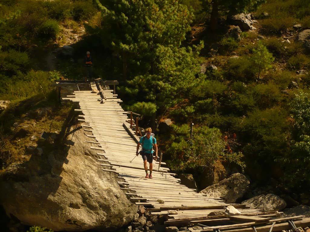
Day 3: Drive from Sankri1 830 mtrs to Taluka 1950 mtrs (12 Kms, 40 mins) and trek to Osla 2560 mtrs (12 Kms, 5 to 6 hrs), Overnight Camping at OslaFrom Sankri to Taluka, the road is pretty rough and has at least 3 stream crossings which make the journey a bit tricky and time consuming. Once we reach Taluka, the trekking finally begins, all the way along the deep blue Supin river that gushes by to our left with green forested mountains all around us. In the distance if the weather is clear, you can catch a glimpse of the Har Ki Dun peak but this is usually covered by cloud during the day and can get obscured due to the terrain, as we walk lower down the valley. We will be walking very close to the river bank, passing by the lofty deodar trees and blooming rhododendrons. There are a few occasions where we will have to cross the river, but the crossing is fairly easy; thanks to the log bridges placed here. The dense forest here is the favored habitat of the Himalayan brown bear but luckily it shuns contact with humans. There are a number of birds that can be found here and an eagle eyed bird-watcher can get to see quite a few amazing species. The first village we pass will be that of Gangar located along the river. It is a small, pretty village with quaint double storied houses made of wood with the lower storey used for livestock while the upper is used for families to reside. The Gangar village follows a unique custom to date – that of “Draupadi pratha” a form of polygamy where girls consider all brothers as their husbands! After passing the village, the valley widens out and the mountain slopes get rockier with less vegetation than before. You will see bright green terraced fields dotting the slopes along the river on the opposite side. These are the only real source of livelihood for the villagers here who have to work really hard for basic necessities. A couple of more hours and a final ascent later, we arrive at the village of Osla where we will camp for the night. The setting is beautiful with the snow covered peaks now looking much closer, seemingly around the valley bend that we will traverse tomorrow. The village of Osla itself is very beautiful with traditional houses made of wood and stone. Do not miss visiting the intricately carved, beautiful temple of wood and stone that is uniquely devoted to Duryodhan!
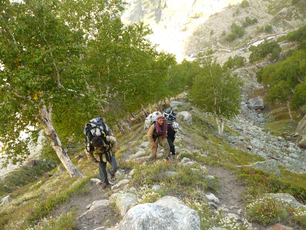
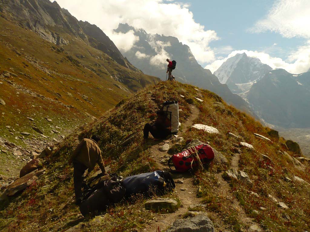
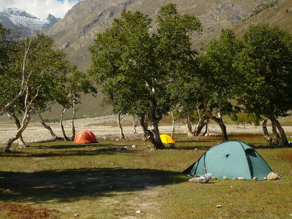
Day 4: Trek from Osla 2560 mtrs to Har Ki Dun 3540 mtrs (11 Kms, 6 to 7 hrs), Overnight Camping at Har ki Dun.We begin our trek today morning, hoping to reach Har Ki Dun campsite if the weather stays good. This trek is well known for fickle weather and if it rains or snows, causing problems, we might need to camp at Kalkattia Dhar. We begin walking on an easy descent amid a path that takes us along a route that is now pretty much devoid of large trees due to our elevation. This is reinforced by the sight of the river appearing like a silvery ribbon almost a 1000 feet below us! After about an hour, we begin probably the first of the tough ascents that await us till our destination. After slowly traversing up the incline, we finally end up at a clearing filled with bright yellow rai (rye/mustard) fields that are a delight for the eyes. The terrain continues sloping slightly upwards but is largely plain and leads onto beautiful green terraced fields surrounded by brown scree slopes with another layers of pine covered hillsides further in the distance with a glimpse of the snow capped Himalayas behind them. The river is no longer visible at this point, hidden far below the left edge of the terraces. A short while later we enter into the deodar forests following the trail that ascends through and with the snow covered peaks now much closer in front and to our right. Usually this section of the trail finds snow, especially if the weather has been inclement. The river now comes back into view far below the narrow trail like a thread, reminding us to be cautious. A short while later, the trail begins to descend with the mountainsides replete with amazing purple coloured flowers and a whole host of butterflies! It gets easier for the next few kms as we now cross through the dark forest and take a turn to the left. The final walk till the valley is pretty gradual, albeit with a few steep sections and quaint wooden bridges that we will cross over. We know we are there when we spot the forest Rest House on a small hillock above the river. The valley has now opened up providing stunning vistas of the incredible peaks all around us leaving us awe-struck with the majesty of the Bandarpoonch peak and the Swargarohini massif with its 4 peaks that are all notoriously difficult to climb. The campsite and the valley further on are usually snow covered on most months of the year and it is the highlight for most of the travelers to revel in the beauty of the contrasts the snow creates with the clear blue skies and the dark green deodar forests. We will camp here for the night and early morning tomorrow we will begin for Maninda Taal after which we will move back for our downward journey.
Day 5: Trek from Har Ki Dun to Osla (11 Kms, 4 to 5 hrs), Overnight Camping at Osla.We need to wake up early in the morning to watch the sunrise hit the towering peaks while we walk along towards the lake. The trek is serene and spectacular and it is pretty common to find the hoof marks of the bharals and the pugmarks of the snow leopard stalking them. Due to its remoteness and abundance of wildlife, the snow leopard thrives in the region and during winters it may be possible to sight the elusive creature enroute to the rarely travelled Borasu Pass beyond Maninda Tal (The Borasu Pass connects the Har Ki Dun valley with the Baspa valley) Keep your eyes peeled to the heaves to sight the great lammergeyers (bearded vulture) and the Himalayan Griffon, both rare and endemic to the remote highlands. After about a couple of hours of walking through snow fields, we arrive at the small Maninda Tal lake, which may be unimpressive in size, but the vista all around it is nothing short of extraordinary. Lofty peaks surround us all around, covered in snow and glistening in the sun, totally undisturbed. This is indeed a sight to remember! We will turn back after spending some time, retracing our route back to the Har Ki Dun campsite, where we will relax for a little while before beginning our journey back down all the way to Osla again. As before, we will pass through the meadow of Kalkattia Dhar and then plunge on downwards till we reach the small village of Seema after which we will cross the wooden bridge that takes us across to our campsite in Osla.
Day 6: Trek from Osla to Taluka (12 Kms, 4 to 5 hrs) and then drive to Mussoorie (172 Kms, 6 to 7 hrs), Overnight stay in hotel at Mussoorie.The trek from Osla is also along the same route as before. We cross the river to reach its true left bank and from then we carry on pretty much parallel to it all the way back to Taluka. It is a fairly easy walk and we should be able to comfortably do it in 5-6 hours. From Taluka we will drive all the way back to Mussoorie along the beautiful countryside. Trek over, we will unwind in the tourist town of Mussoorie back in the trappings of civilization!
Day 7: Drive from Mussoorie to Delhi (275 Kms, 7 to 8 hrs)The drive from Mussoorie to Delhi is not very long and takes us down the hill within an hour to Dehradun from where it’s a pretty straight run along the plains all the way to Delhi.
