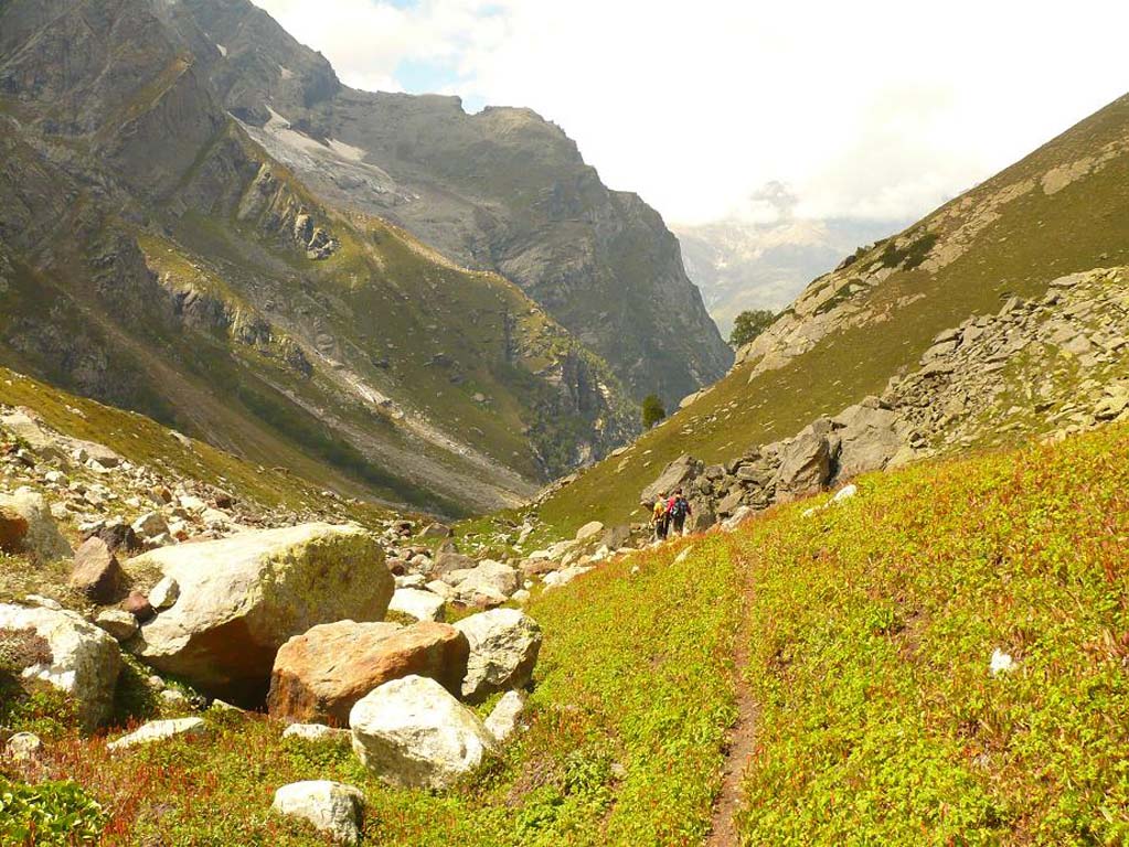
Indrahar Trek
Brief Description
Overview
Region: Dharamsala, Himachal Pradesh
Trekking Altitude: Max (4420 mtrs)
Grade: Moderately Tough
Total Trekking Distance: 56 Kms
Best Season: May to November
Temperature Range: -7°C to 25°C.
Brief Information
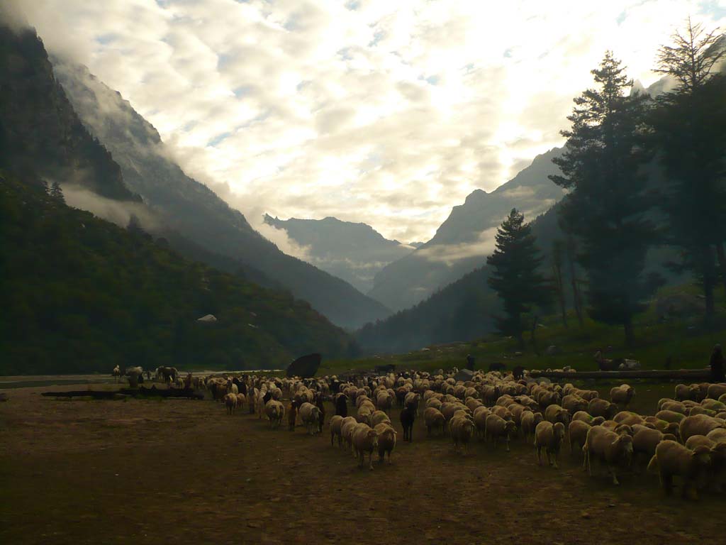
The Indrahar Pass is an extremely popular trek in Himachal Pradesh due to its splendid views and also the fact that it starts from the popular town of McLeodganj which is famous as being the home of the Dalai Lama in exile. Just below McLeodganj is Dharamshala, which has the only international cricket stadium in the Himlayas and is probably the most picturesque in the country with a panoramic view of the snow capped Dhauladhars framing it. Other attractions nearby are the Bhagsu Nag temple, Bhagsu falls and the spectacular neo-Gothic Church of St. John in the Wilderness. Another popular town further up from McLeodganj is Naddi from where you can get a glimpse of the Dhauladhars and the pass itself that we will be attempting. Indrahar Pass lies on the ridge that divides the steep and rocky Kangra valley on one side and the more gradual, lush green Chamba valley on the other. From the top of the pass you get a stunning view of the Dhauladhar range that rises majestically bang in front of you like a massive rock wall. This trek does begin out fairly easy but is quite difficult on either side of the pass. Some of the highlights are the caves we will encounter and the amazing multi coloured flowers that carpet the route on both sides of the valley. During winter, the pass is covered in snow from Triund itself all the way up and becomes extremely difficult to negotiate. The pass is used extensively by the shepherds (gaddis) for grazing and during the summer months, you are likely to find huge herds of sheep scrabbling up the slopes with enviable ease!
Short Itinerary
Day 1: Drive from Delhi to Chandigarh (250 Kms, 4 to 5 hrs), Overnight stay in hotel at Chandigarh
Day 2: Drive from Chandigarh to Dharamsala/Mcleodganj 1750 mtrs(247 Kms, 5 to 7 hrs), Overnight stay in hotel at Dharamsala
Day 3: Trek from Mcleodganj to Dharamkot 1980 mtrs(2 Kms, 1 to 1.5 hrs) and then from Dharamkot to Triund 2810 mts(10 Kms, 4 to 5 hrs),Overnight camping
Day 4: Trek from Triund to Lahesh Cave 3600 mtrs (7 Kms , 3 to 4 hrs), Overnight camping at Laka Got
Day 5: Trek from Lahesh Cave to Chatru Parao 3700 mtrs via Indrahar pass 4420 mtrs (11 Kms,6 to 7 hrs), Overnight camping at Chatru Parao
Day 6: Trek from Chatta Parao to Kuwarsi Village 2730 mts via Mandhara Crossing (14 Kms,6 to 7 hrs), Overnight camping
Day 7: Trek from Kuwarsi to Lamu 1950 mts via Hilling (12 Kms,4 to 6 hrs), Drive to Chamba (51 Kms,2 to 2.5 hrs), Overnight stay in hotel at Chamba
Day 8: Drive from Chamba to Ambala Cantonment (384 Kms, 8 to 10 hrs), Overnight stay in hotel at Ambala Cantonment
Day 9: Drive from Ambala to New Delhi (200 Kms, 3.5 to 4 hrs)
Essential: Do's and Don't / Things to Bring / Inclusion and Exclusion (PDF)
Indrahar Trek - Fact and Info (PDF)
Indrahar Trek - Detailed Itinerary (PDF)
Fact & Info
INTERESTING FACTS/INFORMATION ABOUT THE PLACE
Chamba District
Chamba is a district in the Northwest of Himachal and is famous for its beautiful temple architecture and well preserved traditional artifacts.Its headquarter is the town of Chamba which houses a beautiful wooden palace that has been converted to a museum. Among the notable places in Chamba are the little hamlet of Khajjiar that has received the moniker of being “Mini Switzerland” and the exquisite town of Dalhousie that is a popular summer and winter destination.
BharmourBharmour is a small town (and erstwhile capital of Chamba district) that lies approximately 60 kms due south west of the town of Chamba. The road to the town goes along the Ravi river and keeps ascending as the sheer gorge keeps deepening to the left. The town is famous for its 84 ancient temples from the 7th to the 10th century AD. The temples have exquisite carving in stone and wood and lie in a bowl flanked by snow capped mountains on all sides. Enroute to Bharmour from Chamba, keep your eyes peeled for a sight of the majestic Manimahesh Kailash mountain that is regarded as one of the holy abodes of Lord Shiva.
DalhousieDalhousie is a charming hill station that was favoured by the British as a retreat for its officials. It straddles 5 hills and has an elevation that varies from 6,000 to 9,000 feet. A number of lovely colonial bungalows and hotels lie along the entire stretch of the town that leads up to the Kalatop Sanctuary. The sanctuary is a thicky wooded, beautiful pine and deodar forest that houses its most famous inhabitant – the black bear. The highest point of the town is the Dainkund peak which is believed to be the residence of many witches.You can get spectacular panoramic views of the Punjab plains and the Pir Panjal and Dhauladhar ranges. In winter, the town gets a lot of snow and is a very popular haunt for traveler from Punjab and other states due to its easy accessibility.
KhajjiarKhajjiar is a small hamlet built around a beautiful lake surrounded by rolling meadows and dense pine forests with the Dhauladhar ranges forming a snowy backdrop in the distance. It is also called Mini Switzerland because of its strong topographical resemblance to Switzerland, with its rolling meadows turning into thick snow fields in the winter. In summer, the town is a hub of adventure sports, such as para sailing and zorbing while in winter, the benign snow slopes lend a magical fairy tale quality to the hamlet. Khajjiar can be visited from Dalhousie via a road that goes through the dense Kalatop Sanctuary and also from Chamba town.
Kangra DistrictThe Kangra district is the most populous district in Himachal and lies just below Chamba District. Its capital is Dharamshala, and the town of McLeodganj is famous as the seat of the Dalai Lama in exile. Kangra district is also famous for the kangra fort and its ancient rock cut Masroor temples that are likely to be a UNESCO World Heritage site.
Church of St. John in the wildernessThis is a beautiful secluded church deep in the deodar forests on the outskirts of Dharamshala. It has been built in the neo Gothic style and has fantastic Belgian stained glass windows. Its solitude and beauty is just the recipe for a few quiet moments of introspection, which makes this worth a visit while in Dharamshala.
Norbulingka InstituteThe Norbulingka Institute at Sidhpur near Dharamshala is named after the erstwhile summer residence of the Dalai Lama in Tibet. It is an aesthetically designed squat building complex based upon the proportions of Avalokiteshwara, the thousand armed God. Its primary objective is to create awareness of Tibetan values and education and to ensure the traditional arts and crafts flourish, alongwith providing training in creation and restoration. Free guided tours are available on all days except Sunday and the Institute also conducts workshops for those who wish to study Tibetan art and craft.
Kangra FortThe Kangra Fort is the largest fort in the Himalayas and one of the oldest dated forts. It was built by the Katoch Kingdom that traces its roots back to the times of the Mahabharata. The fort is an impressive example of stone architecture battlements standing just outside the town of Kangra and also has the intricately carved Lakshmi Narayan temple near it.
Masroor Rock Cut TempleThe Masroor Rock Cut Temple (or Himalayan Pyramid) is a complex of beautiful monolithic rock cut temples from the 6th - 8th century AD in a mix of traditional shikhara and Himachali style of architecture fronting the beautiful Masroor lake. The architecture style is strongly reminiscent of the temples at Angkor Vat and is likely to be part of the UNESCO World Heritage List shortly.
Kullu districtKullu is the prime administrative district in Himachal Pradesh and is also the most populous. The largest valley in the district is the Kullu valley (also known as the Valley of the Gods) where we have the famous hot springs of Bashisht and the popular tourist town of Manali. The northern border of the Kullu district is bounded by the Rohtang pass that is one of the most visited tourist destinations in the state. The river Beas is the primary river that flows through the district and most of the big towns such as Manali and Mandi lie along its banks.
Kullu valley/ManaliIt is a broad open valley famous for its sprawling apple orchards and the equally famous pashmina and angora shawls. The airport to access Manali town is located at Bhuntar near Kullu town, about an hour away (by car). The primary religion of people in the valley is Hinduism and there are many famous temples in the valley where people come from far and wide as a pilgrimage.
Indrahar Trek - Fact and Info (PDF)
Detailed Itinerary
Day 1: Drive from Delhi to Chandigarh (250 Kms, 4 to 4.5 hrs), Overnight stay in hotel at Chandigarh
The very first day of what we are sure will be a memorable trip, starts with a round of introductions, after which we get into our vehicles for the drive from Delhi to Chandigarh. This is a pretty straightforward stretch, with the road being the usual city highway and we should be in Chandigarh by evening. If we reach early, it’s worth spending some time at the Nek Chand Rock Garden and later soaking in the night ambience of Sector 17. Tomorrow we will head into the hills and stay overnight at McLeodganj.
Day 2: Drive from Chandigarh to Dharamsala/Mcleodganj 1750 mtrs(247 Kms, 5 to 7 hrs), Overnight stay in hotel at DharamsalaThe road from Chandigarh to Dharamshala is pretty flat in the beginning as it leads through Punjab, past the huge Gobind Sagar Dam that is the lifeline of Punjab. From Amb, the road will turn due North East and cross over the Beas River as it moves into the state of Himachal Pradesh. While the road does have its gradual dips and rises, there isn’t much climb until it skirts past Gaggal after which the final 30 minute stretch to Dharamshala is a constant ascent along a well metalled road snaking along the hill all the way up. From Dharamshala it is a 15-20 minute drive up towards McLeodganj where we will halt and check in to our hotel. The evening will be spent exploring McLeodganj by visiting the Residence and monastery of his Holiness “The Dalai Lama”, then proceeding on towards the church of St John in the Wilderness and the Dal Lake, with a quick trip upto Naddi for some views of the Dhauladhars, before we retire back at MCLeodganj in time to do a bit of shopping in the night along the Tibetan market.
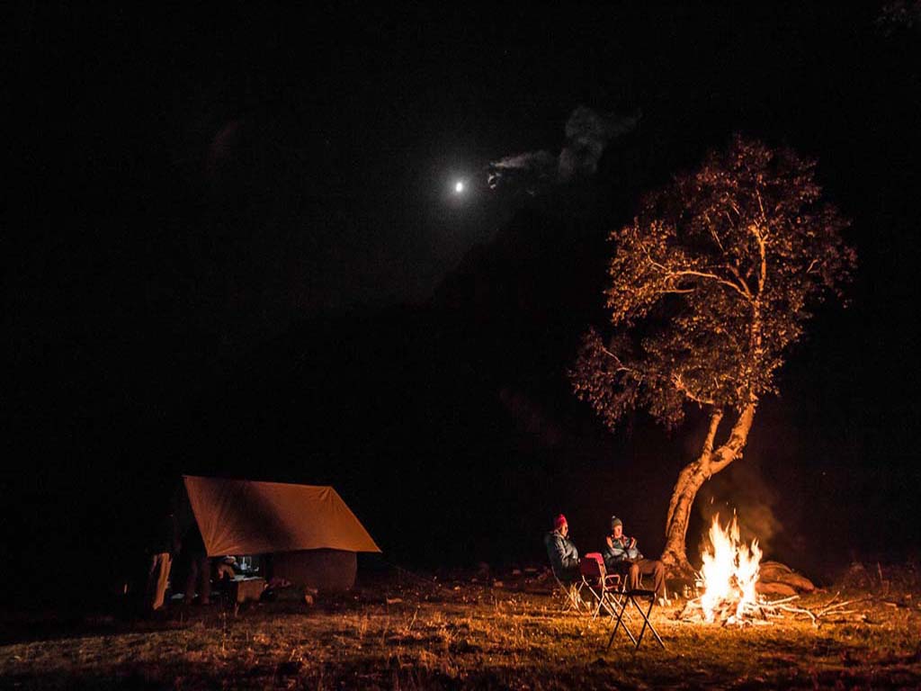
Day 3: Trek from Mcleodganj to Dharamkot 1980 mtrs(2 Kms, 1 to 1.5 hrs) and then from Dharamkot to Triund2810 mts(10 Kms, 4 to 5 hrs),Overnight campingThe beginning of the trek starts off easy with a drive or a trek till Dharamkot from where we tighten our trekking boots and hit the trail. We will walk up and enter the thick pine forests that ring the slopes above the village. We will be walking along the dark trail for a while till we reach a clearing which is where the Galu Devi temple stands. We can take a short tea break here at the stall that welcomes visitors going up along the trail. There will be a fork ahead of which one of the side paths leads to the village of Naddi below, while the other goes to Laka. We will continue along the straight path that leads on towards Triund. The trail plunges on through the thick oak forest and then rises up through a varied vegetation of deodars and rhododendrons as the path gets steeper and the altitude higher. About halfway up the path, you can observe the village of Dharamkot and the town of Dharamshala in the distance with the cricket stadium a prominent landmark far below! The final stretch up to Triund is quite steep and will lead along sharp switchbacks and hairpins as we traverse the serpentine trail through the fantastic oak trees and compact rhododendron thickets that are a blaze of colour during their flowering season. After about half an hour of further steep climbing and we finally reach a lush green meadow at the top of the ridge that stretches in a gentle slope all around. This is the Triund meadow where you will see a few shops here and a forest rest house as well. This is our destination for today, and the tents will be put up at a suitable camping ground in the stunning view of the Dhauladhar range that stares at you like a rock wall barely an arm’s length away! Lahesh caves and the Indrahar pass can be seen from here both of which seem like a daunting steep climb ahead of you.
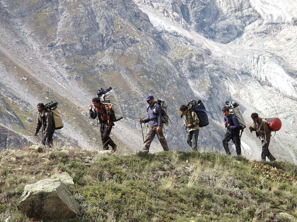
Day 4: Trek from Triund to Lahesh Cave 3600 mtrs (7 Kms , 3 to 4 hrs), Overnight camping at Laka GotToday will not be a long trek but it is likely to be quite strenuous as there are a few steep sections we will encounter. We begin with the trail leading upwards along boulder strewn cliff flanks that is the norm in the Dhauladhars. The entire range has a sharp profile with the higher reaches composed of large and steep boulder faces. After ascending the hillock behind the Rest House, we come across a grassy section that is relatively flat. Post monsoon during the flowering season, there is a profusion of scarlet, purple and yellow wildflowers along this trail that gives us company all the way till we reach the Tirange Wali mata shrine after approximately an hour’s walk. This is one of the shrines revered by the local gaddis who maintain the shrines and indeed the entire trail, carefully clearing out any obstacles and making the steeper sections easier with boulder steps. The view from near the shrine is magnificent with the Dhauladhars looming ever closer while the Triund meadow can be seen at the back alongwith the wooded gorges and streams that flow down the flanks of the mountains. A short walk later, we will reach the grassland of Laka and will take a break at the small tea shop called the “Snow Line café” before we traverse our way along the broken and grim grey boulder field maze, following the cairns. We will cross over the stream flowing from the remnants of the Laka glacier and then begin the steep climb among the gigantic flanks of the canyon like rocks. The skyline is dominated by the looming Dhauladhars and the Mon and Camel peaks that straddle the Indrahar Pass ridge on either side. The climb takes about an hour or two to complete and you will know its nearing the end when you see a profusion of purple flowers along the shelf that lies just outside the Lahesh Cave. The Lahesh Cave is a relief as we finally dump our bags and slump down at the entrance outside the cave which is basically an interesting formation of boulders rather than a true cave! It is a long narrow wedge like gap between two boulders that has been augmented by the gaddis by filling any gaps and thus insulating it against the wind. It is a cosy place but could get claustrophobic since its ceiling is barely 2-2.5 feet high! We will sit outside the cave on the ledge and relax, enjoying the stunning sunset as we get ready for our toughest day tomorrow.
Day 5: Trek from Lahesh Cave to Chatru Parao 3700 mtrs via Indrahar pass 4420 mtrs (11 Kms,6 to 7 hrs), Overnight camping at Chatru ParaoDay 5: Trek from Lahesh Cave to Chatru Parao 3700 mtrs via Indrahar pass 4420 mtrs (11 Kms,6 to 7 hrs), Overnight camping at Chatru ParaovvWe need to wake up and get moving very early in the morning in order to make our camp before nightfall on the other side of the pass. The clear morning skies will reveal the task that lies ahead, striated and veined grey granite rock faces that rise steeply above us. The pass can be seen about 1,000 metres above us as we begin our steep climb toward the North East keeping the Mon Peak to our right. The climb is over step like boulders placed by the gaddis interspersed with flatter and easier ledges that cantilever out over sudden drops, so care is advised! We will keep climbing gradually until we come to about 3,500 metres where a small shrine stands testimony to a breathtaking vista of the cloud covered valley far below. From here on, the climb gets even steeper and you can feel the pass getting ever closer as the wind picks up pace and starts whistling around us. At around 4,000 metres we again come across a glacial stream that we will cross and move further up. The end is now very near and after a short scramble up, we are finally at the stunning vista of the pass with the snow capped mountains in the distance framing the lush green Chamba valley that lies spread out below us. On a clear day you can even see the famous Manimahesh Kailash Peak from here! The Kangra valley to our back is a complete contrast, blanketed by thick white clouds and to both our sides are the two peaks – Mon Peak and Camel Peak that flank the pass like tall sentinels. After taking in the view for a while, we will begin our tough and long journey downward. The route down is extremely steep and caution is advised as it requires carefully stepping down through an irregular boulder field with a few glacial pockets. After half an hour, we will come across a level area with a dry rock bed to the left, known as Sukh Dali. The trail then again continues steeply until it finally levels out with a large snow field, with green flowering slopes in patches and the stark rocky barren spires of the mountains staring bleakly around us. Just a little further ahead, the valley view opens up revealing the complete vista of the huge valley beyond and from here, our camp Chhata Parao can be seen as a gentle green meadow about 2,000 feet below in the valley of Kuwarsi nala. We will have to cross a couple of streams as we go further lower and walk on amid beautifully carpeted rolling meadows with yellow flowers. We will continue to weave our way past boulder patches, mini waterfalls and skirt along small streams with patches of waist high grass and vegetation, as we get lower until finally after a long arduous downward trek, we reach our campsite late in the day. It has been a very long day and the rest is more than welcome! Tomorrow however promises to be almost as long, though less arduous.
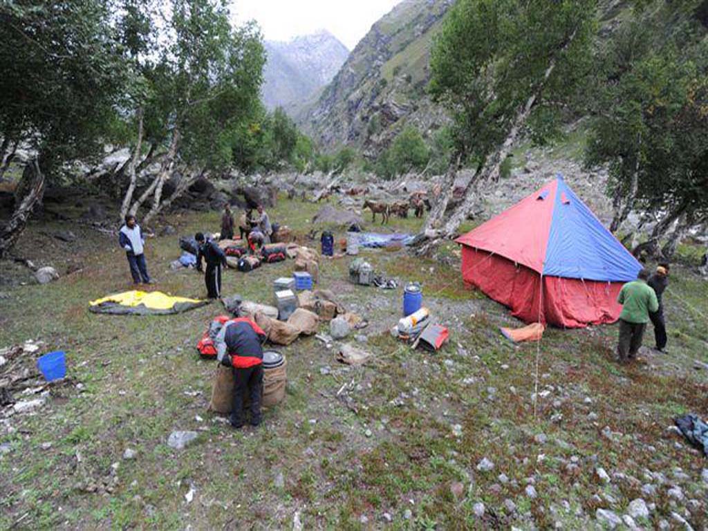
Day 6:Trek from Chatta Parao to Kuwarsi Village 2730 mts via Mandhara Crossing (14 Kms,6 to 7 hrs), Overnight CampingToday also we get up early to begin our long trek down to Kuwarsi village. The vegetation here is noticeably different as compared to the Kangra end. The snow line is lower, the vegetation looks dense and unspoiled and the forest is said to abound with Himalayan wildlife such as the brown bear and the leopard! Another couple of hours of descending along the lush green slopes covered by dark pines, the trail take a steep dip down to the Kuwarsi Nala gorge that rushes far below. The descent is along the trail that dives down rocky canyons that lead down to the banks of the gorge after some tough scrambling. If we manage to reach the gorge early in the day, the crossing is much easier as compared to afternoon when the stream swells up with the melting ice being carried down from the peaks above. We will cross the stream and then again begin our ascent up the other side of the gorge through dense pines. The trail will traverse a number of hills and ridges as it ascends and descends alternately all the way along for the next 4 hours odd. As we climb higher, the views of the Pir Panjal range come tantalizing into view through the sporadic openings in the foliage. After continuous ascents and descents, we come across a shepherds halt – Mandhara Got, which is a grassy plain surrounded by the pine forest. Another interesting aspect of the trail is the presence of a few caves along the rocky sides on your way to Mandhara Got. These act usually as animal shelters and should be approached cautiously (if at all!) just beyond the pasture, we will come across a thick forest of huge deodars that will lead us on towards our final descent after which we will come across level fields and finally the Nag mandir just outside Kuwarsi village. Just beyond this we finally reach the village which is a traditional shepherd village with wooden houses (albeit with modern dish antennae!) We will camp for the night after our long tiring walk.
Day 7:Trek from Kuwarsi to Lamu 1950 mts via Hilling (12 Kms,4 to 6 hrs), Drive to Chamba (51 Kms,2 to 2.5 hrs), Overnight stay in hotel at ChambaThe final day of the trek is relatively easier with a gradual ascent along a trail through the dense pines that narrows down and skirts the Kuwarsi gorge lying below a sheer precipitous drop. This is the trickiest section of our trek today but after a short while you come across a stream that fords the path and leads onto wooden steps that lead downwards, making it easier to get past the tricky zone. After this it is a gentle but long walk through the forest until we reach Hilling village. Once the village is crossed, it is not far till the metalled road which leads further on to Lamu village which is not much further ahead. Lamu village is the roadhead from where we will drive to Chamba where we will check in to our hotel and finally end our trek.
Day 8: Drive from Chamba to Ambala Cantonment (384 Kms, 8 to 10 hrs), Overnight stay in hotel at Ambala CantonmentToday we will be driving down all the way to Ambala Cantonment, skirting Dalhousie (which will be on our left) and crossing past the huge Ranjit Sagar dam built along the Ravi river. From here we will then drive to the west, taking the Pathankot bypass and continue paralleling the Beas river until we turn towards Jalandhar from where we will move east towards Ambala via Phagwara. Ambala will be our halt for the night with the final leg coming up tomorrow.
Day 9: Drive from Ambala to New Delhi (200 Kms, 3.5 to 4 hrs)The drive from Ambala to Delhi is a short one and pretty uneventful. It is a fairly straight highway and should get us to Delhi in about 3 to 4 hours fairly easily.
