Kuari Pass Trek
Brief Description
Overview
Region: Garhwal, Uttarakhand
Trekking Altitude: Max (3640 mtrs)
Grade: Easy to Moderate
Total Trekking Distance: 42 Kms
Best Season: Throughout the year (avoid in Rainy season i.e. Mid July and Aug).
Temperature Range: -0°C to 20°C.
Brief Information
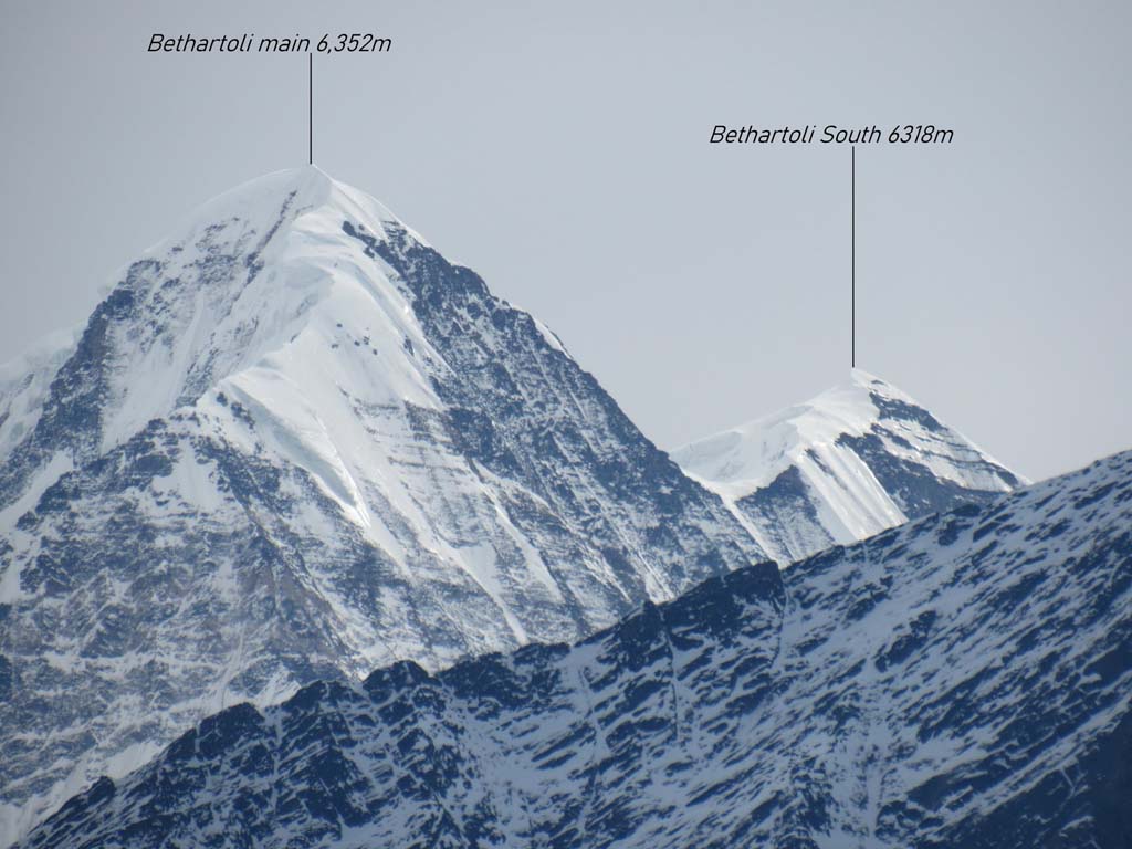
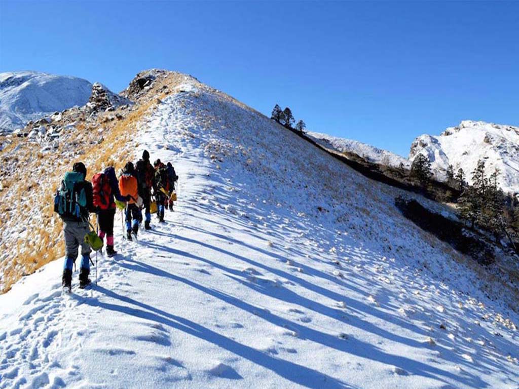
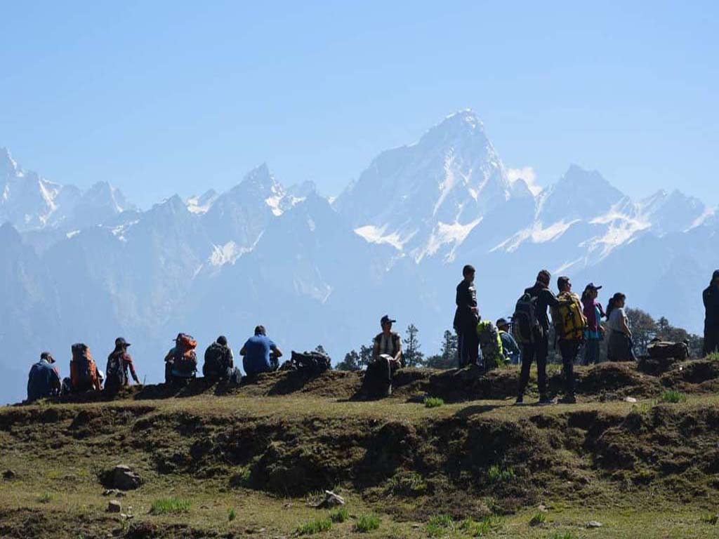
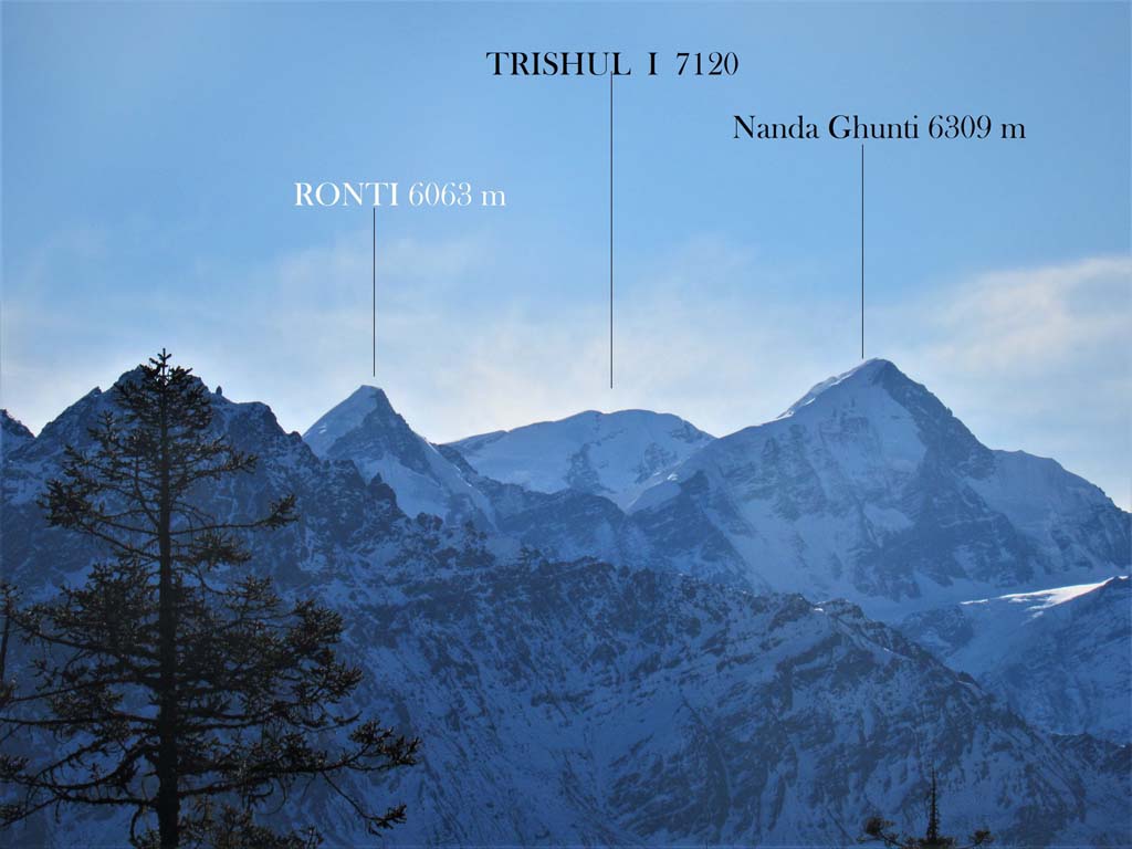
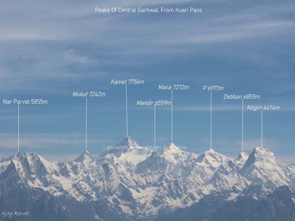
Kuari Pass trek is an extremely popular trek in Garhwal, and for good number of reason. It is another of the handful treks that can be done both in summer and winter and is also easy enough that first timers can undertake it fairly comfortably. It is also known as “Curzon Trail”, named after the British Viceroy Lord Curzon, who loved to trek in the Garhwal Himalayas and was one of the pioneers of the route. This is a beautiful trek that leads up through gradual slopes and meadows until you reach the wild and windy ridge line which you need to traverse for a while, before descending on the other side. The view from the ridge is spectacular with the most famous Garhwal peaks surrounding you, from Nanda Devi to Dunagiri, to Hathi Ghora and the majestic Kamet pyramid. In winter, the route is blanketed in white and has a serene beauty about it that makes you feel you are much higher than the real altitude you are at, while in summer, patches of snow and vast snowfileds of un-melted snow, mix among the multitude of bright, yellow wildflowers that grow in abandon in the meadows. This is a route that is frequented by the “gaddis” (shepherds) of the region and there is a good chance of spotting large herds of handsome “pashmina” sheep grazing in the meadows. Another interesting aspect of this trek is that there are two different routes to Kuari Pass, dependening on whether it is summer or winter.
Short Itinerary
Day 1: Drive from Delhi to Rishikesh (250 Kms, 5 to 7 hrs), Overnight stay in hotel at Rishikesh
Day 2: Drive from Rishikesh to Joshimath (255 Kms, 7 to 8 hrs), Overnight stay in hotel at Joshimath
Day 3: Drive from Joshimath to Dhak (14 Kms, 30 mins), Trek from Dhak 2100 mtrs to Gulling 2450 mtrs (8 Kms,4 to 5 hrs) , Overnight camping
Day 4: Trek from Gulling to Tali/Khullara 3100 mtrs (6 Kms, 3 to 4 hrs), Overnight Camping
Day 5: Trek from Tali/Khullara to Kuari pass 3640 mtrs and back to Tali (15 Kms, 7 to 8 hrs), Overnight Camping.
Day 6: Trek from Tali /Khullara to Auli 2750 mtrs (13 Kms, 5 to 6 hrs), Drive from Auli to Joshimath (15 Kms, 30 mins), Overnight stay in hotel at Joshimath
Day 7: Drive from Joshimath to Haridwar (275 Kms, 7 to 8 hrs), Overnight stay in hotel at Haridwar
Day 8: Drive from Haridwar to New Delhi (215 Kms,5 to 6 hrs)
Essential: Do's and Don't / Things to Bring / Inclusion and Exclusion (PDF)
Kuari Pass Trek - Fact and Info (PDF)
Kuari Pass Trek - Detailed Itinerary (PDF)
Fact & Info
INTERESTING FACTS/INFORMATION ABOUT THE PLACE
Joshimath
The name Joshimath is derived from “Jyotir-math” where “math” can be translated as a monastery. It is the northernmost monastery among those established by the seer Adi Shakaracharya, who had travelled extensively in the Garhwal Himalayas. It lies in the Chamoli district, and is the base for a number of treks and expeditions to some of the highest and most picturesque peaks in India. It has a number of interesting temples with their associated myths, none more so than the Narsinh Temple.
Narsinh TempleThis is the main temple of Joshimath and is dedicated to Lord Vishnu in his avatar of “Narsinh”, half man and half lion. As per the local mythology, if and when the right hand of this idol of Narsinh breaks (and it is currently on the verge), the mountains of Jay-Vijay en-route to the Badrinath shrine, will come together in a cataclysmic event, and the deity of Lord Badrinath in the Badrinath shrine shall disappear and re-appear from the ground as a solid black stone 10 kms away from Joshimath, at Bhavishya Badri. This may not seem far removed from a possible disaster, since the region lies on a fault line and is prone to seismic events!
AuliAuli is a ski resort in the state of Uttarakhand and lies a few kms above Joshimath. It is surrounded by spectacular peaks, primary among them being the tallest peak that lies completely within India – Mt. Nanda Devi. The Auli ski resort has a ski lift and an artificial lake that is frozen over and is used to generate snow for preserving the ski slopes if the powder snow is inadequate. Auli also has a Hanuman temple in memory of a short rest that Lord Hanuman is said to have taken while on his way to get the Sanjivani herb. Auli is also the training centre for the ITBP (Indo Tibetan Border Police) who are regarded as one of the best warriors guarding our borders.
TapovanTapovan is a beautiful little wooded hamlet that literally means forest of meditation. It is 15 kms away from Joshimath and has hot springs and a small temple. It is the one of the start/end points of the complete Curzon Trail.
Vasudhara Falls and BadrinathIf you go for the trek during summer, it is worth going on a day excursion to Vasudhara Falls. You can drive to Mana village from Joshimath (the last Indian village before the Tibet border) and then trek 3 kms to Vasudhara Falls. The trail is over largely rocky terrain until you come to a tall cliff that is approximately 500 feet high, from where the waters of the Vasudhara river (which later on joins the Alaknanda) gush through with spectacular force. You can see the Chaukhamba, Balakun and Nilkantha peaks as also the bottom of the Satopanth glacier rolling down to the bottom of the Vasudhara river. From here, you can also plan a trek to Laxmi Van forest and then further on to Satopanth Glacier. This will however require camping and we will make all necessary arrangements if informed in advance. Another short excursion is possible from Mana village, where you could go upto the holy shrine of Badrinath which is 9 kms away. Usually the trip to Vasudhara Falls and Badrinath can be done together in a single day, if you leave early in the morning. The trek to Satopanth Glacier however takes a couple of days.
Kuari Pass Trek - Fact and Info (PDF)
Detailed Itinerary
Day 1: Drive from Delhi to Rishikesh (250 Kms, 5 to 7 hrs), Overnight stay in hotel at Rishikesh
We meet in Delhi and begin our drive as early as possible, so that there is some time to explore Rishikesh in the evening. The drive by itself is unspectacular until we come across the holy ghats of Haridwar where we will skirt the wide and swift flowing river Ganga. From this point on, the road gets more interesting with a climb up the wooded foothills of Rishikesh, passing by the various Yoga ashrams and retreats that Rishikesh is known for. Check-in to the hotel and venture out in the evening along the banks of the river Ganga, or enjoy a walk along the Laxman and Ram Jhula, the famous suspension bridges of Rishikesh.
Day 2: Drive from Rishikesh to Joshimath (255 Kms, 7 to 8 hrs), Overnight stay in hotel at JoshimathWe need to start early in the morning for Joshimath since it is a long drive and there can be traffic jams along the route due to the road being narrow. It is a picturesque journey with the lovely blue river Ganga a constant companion on our right. You can see the colourful kayaks and rafts dotting the spectacular white sands. After a few hours, the road begins ascending sharply and we will encounter the beautiful confluences of the rivers that make the Ganga, with the Alaknanda being the primary arterial river meeting the others at Rudraprayag, Karnaprayag,and Nandaprayag. We will reach Joshimath by evening and will check into the hotel for a well deserved rest!
Day 3: Drive from Joshimath to Dhak (14 Kms, 30 mins), Trek from Dhak 2100 mtrs to Gulling 2450 mtrs (8 Kms,4 to 5 hrs) , Overnight campingToday we drive in the morning from Joshimath to Dhak village which is 12 kms further, along the Tapovan road. The gradual ascent begins from here along paths that lead through or adjoining terraced farms. As you climb higher, you will see the Kharchi village further ahead, and far below you will see the Dhauli-Ganga river rushing through the valley. We will rest a while, refill our bottles and enjoy the view of the sharp arrowhead shaped Mt. Dunagiri, poking out distinctly in the distance. The trail passes through the village and then starts ascending up towards the mountain ridge in the distance. Just below the ridge, lies the dense Chitrakantha forest where we will be proceeding to via the potato and apple farms that can be seen dotted in the distance. We will pass a couple of small villages before we reach the base of the forest from where we will ascend steeply through the oak and rhododendrons. After about half an hour of climbing, we will cross a stream and from there on, it is a short walk to the Gulling campsite where you can see the squat Hathi Parbat (Elephant Mountain) and its companion, the Ghoda Parbat (Horse Mountain) This unusual pairing of peaks is quite a definitive sight along the trek and you can clearly see the distinct profiles of the animals in the shape of the ridge-lines. We halt overnight here and prepare for the next day as we go up higher into the snow-line.
Day 4: Trek from Gulling to Tali/Khullara 3100 mtrs (6 Kms,3 to 4 hrs), Overnight CampingToday the trek is short, but involves a few sections of steep hiking. We begin our trek again crossing the stream from yesterday evening, and hiking upwards through the dense oak and rhododendron forest to the ridgeline. This is a steep climb of almost 400 feet which will take you to a shade under 10,000 feet altitude until you come to a clearing with the “gaddi” (shepherd) huts. After a short break, we continue following the trail into the forest and move upwards to the ridge. Peeking above the ridge, you will catch sight of the snow covered Pangarchulla Peak, which is a trekking peak and shares most of its route with the Kuari pass trek, with the big difference being the bifurcation from the Curzon Trail ridgeline. We now come across a couple of route options, one is shorter and easier and leads directly to Khullara, while the other bifurcates around Bor Taal and adds another 4 kms to our total distance. If the progress has been quick and all group members agree to it, this is a roundabout worth taking. After a gradual climb in the beginning that takes you deeper into the forest, the trail will level out and after a short walk of about 45 minutes, you will come across a small temple on the banks of a small pond. This is Bor Taal and is a good spot to take a short break to refresh yourself. Half an hour of comfortable walking through a largely flat forest trail brings us to the toughest part of our trek today. As you exit the forest, you can see a steep barren slope leading up to a ridge. This is the Tali ridge and you will see the trail switching back and forth up the slope. About 45 minutes of hard climbing and you are finally at the ridge with a clear view of Nanda Devi and Dunagiri right in front. Our trail leads further up for a short while along the ridge till we reach a level ground. This is the Tali campsite from where you can see the route that goes to Pangarchulla Peak base as also into the forest below. During inclement weather conditions, camp may be pitched in the forest further ahead (in order to have more protection from the elements), in which case you need to go on further into the forest until you come across a stream adjoining large boulders where we would finally setup camp.
Day 5: Trek from Tali/Khullara to Kuari pass 3640 mtrs and back to Tali (15 Kms, 7 to 8 hrs), Overnight Camping.We have a fairly long day of trekking in store, most of it through snow, and will have to begin early in the morning. We will be climbing up to the highest point of our trek, the Kuari Pass and will be returning as well. If we have camped in Tali, we will enter Chitrakantha forest below the ridge and then make a gradual ascent all the way up to Chitrakantha Top via the Khullara meadows. As you walk past the meadows, you will gain yet another uninterrupted vista of the mighty Garhwal Himalayas that have been awe-inspiring us virtually every day. The trail further on, will be through undulating forest terrain that takes you into a birch forest after which it is only about half an hour’s climb to reach Chitrakantha Top. From the top, you get a rare 360 degree view of the surrounding Peaks, including the base of the constant companion, Pangarchulla peak. We will now be descending onto a lower ridge line that joins the Curzon Trail that comes from Tapovan. We will be walking along the Curzon Trail until we cross a stream and reach the col (lowest point on a mountain ridgeb/w 2 peaks) known as Puli Dhar after yet another stiff climb up snow slopes. From Puli Col, which is the highest point, we descend slightly along the ridge to our destination Kuari Pass, trekking along extensive snowfields. We will break here and enjoy the spectacular views and the solitude that is equally charming in summer as well as winter, before we re-trace our steps and return to camp in the evening. Caution is advised on the return journey, since the snow and ice patches can get slippery and tricky to navigate during the downward descent.
Day 6: Trek from Tali /Khullara to Auli 2750 mtrs(13 Kms, 5 to 6 hrs),Drive from Auli to Joshimath (15 Kms,30 mins), Overnight stay in hotel at JoshimathMorning begins with an easy walk down to Tali lake where you can see the fantastic reflection of the mountains bang opposite us. In summer, you could get lucky to find the beautiful and rare cobra lily that grows along the banks of this lake. After a few moments at this mesmerizing lake, we ascend up the Tali ridge, which we will traverse and then move onto the Gorson ridge. This ridge will take you to Gorson top, from where you get a fantastic view of Nanda Devi alongwith all the other Himalayan giants. The ascent up to Gorson Top can be strenuous and if this is to be attempted, it is advisable to leave camp early. From Gorson Top we come down to Gorson meadows via a narrow trail that clings along the mountain slopes. The Gorson meadows are a popular junction for the gaddis (shepherds) and it is always possible to find a large of sheep meandering along. You are also likely to find patches of hard packed snow along the slopes here which remain away from the sun. Gorson meadows is also a campsite which is the first camp that groups setup when trekking upto Pangarchulla Peak from Auli (this is the other route to Kurai pass as well) The soft, pastel green meadows are a beautiful sight as they undulate like a carpet reminiscent of Scottish meadows and golf courses. Near the Gorson campsite, there is a small pond and just beyond it on the horizon stand the peaks that have been a constant sentinel all along our route. After traversing the glades of Gorson meadows, we enter a dark forest that leads on towards a small, stone temple from where the trail is clearly defined and descends sharply down past the ITBP obstacle course, to the Auli ski resort ski-lift and finally onto the roadhead. This is where we end our trek still in the presence of the fantastic rugged peaks that surround Auli. The drive down from Auli to Joshimath will take about 15-20 mins and we will check into a hotel for the night.
Day 7: Drive from Joshimath to Haridwar (275 Kms, 7 to 8 hrs), Overnight stay in hotel at HaridwarThe drive from Joshimath to Haridwar is pretty long and follows the gushing Alaknanda far below on the right hand side. Watch out for the fantastic views of the river confluences at Rudraprayag, Devprayag and Karnaprayag. While the journey is beautiful, it is also quite a thrilling drive, with the narrow roads and the deep gorges along one side. Near Rishikesh, you will see a number of adventure operators offering kayaking and river rafting and you can see resorts and rafting camps on the white river sands. The road from Rishikesh to Haridwar is pretty straight forward and we will make quick time along it. We should be able to reach by around late evening.
Day 8: Drive from Haridwar to New Delhi (215 Kms,5 to 6 hrs)The drive from Haridwar to New Delhi is through the plains via Roorkee, Meerut and Ghaziabad and is almost an anti-climax after the beautiful time spent amidst the sublime Himalayan beauty.
